Step 1.
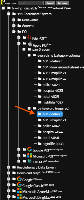
bus stop is part of POI, you can search POI by keyword "bus stop"
Step 2.
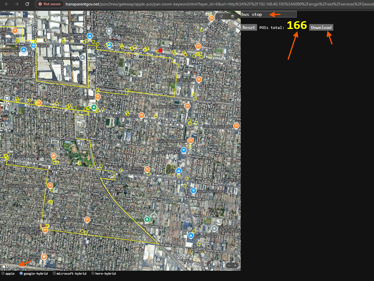
this is free apple POI, search key word "bus stop"
found 166 bus stop, click download button
https://transparentgov.net/json2tree/gateway/apple-poi/pan-zoom-keyword.html?layer_id=6&url=http%3A%2F%2F192.168.40.105%3A6080%2Farcgis%2Frest%2Fservices%2FGeovalidation%2FFlexMap_Dark%2FMapServer&layer=hp_dispatch¢er_lat=33.985485434785346¢er_long=-118.19112345400406¢er_zoom=0.009%2C0.010&panto=0&poi=bus+stop
Step 3.
after click download button,
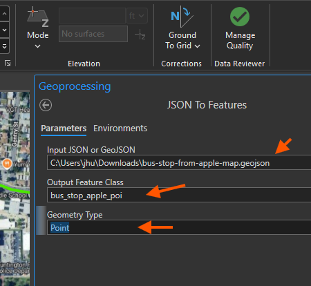
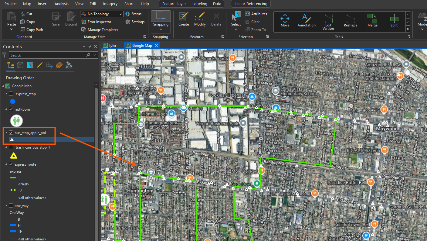
import geojson into arcgis pro

Step 4.
import geojson into arcgis pro
Step 5.
Step 6.
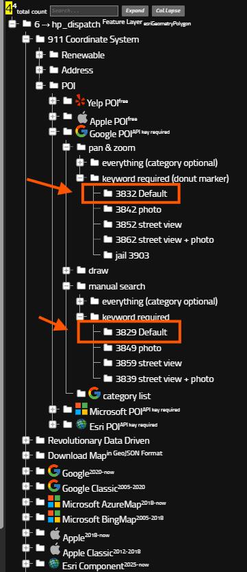
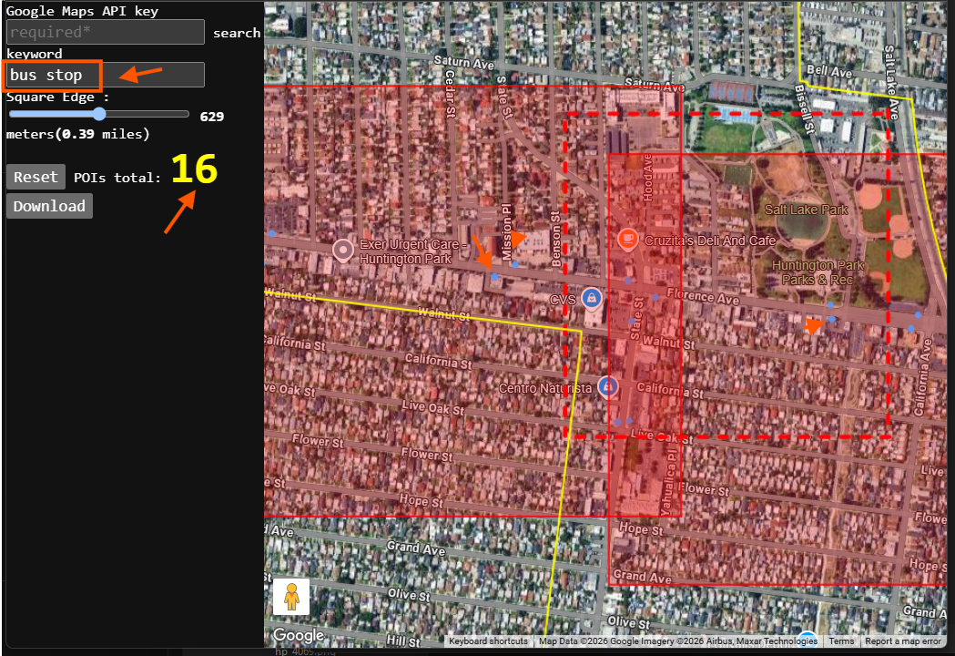
google POI also works the same way.
but not free, need your google api key
Step 7.
google POI also works the same way.
Step 8.
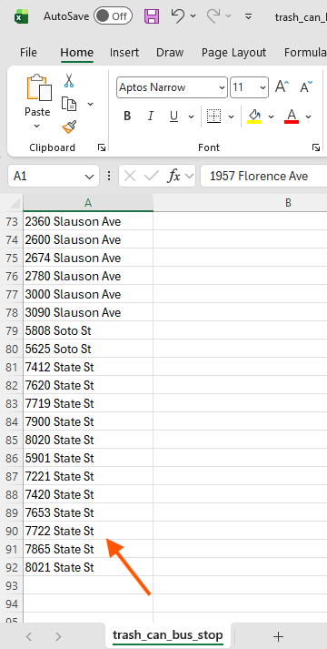
if you already have bus stop address, import them into excel file.
Step 9.
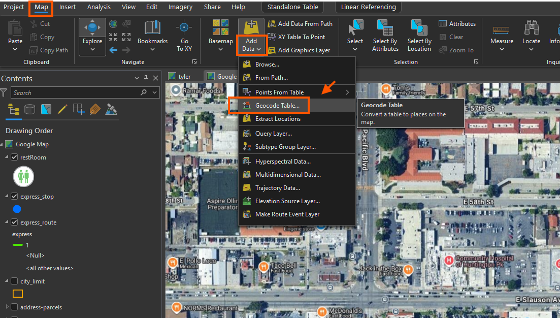
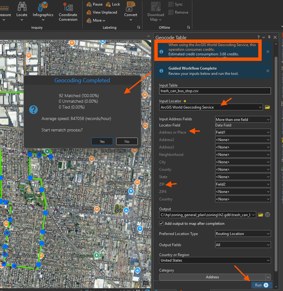
geocode excel table
Step 10.
if you use ESRI's world locator, will cost your credit a little bit.
If you use your own locator, will be free.
address is based on parcel,
geocode address could place the point on top of building roof ( bus stop should not be on top of building roof )
use routing location type, will make sure the bus stop is on the road, not on building roof.
Step 11.
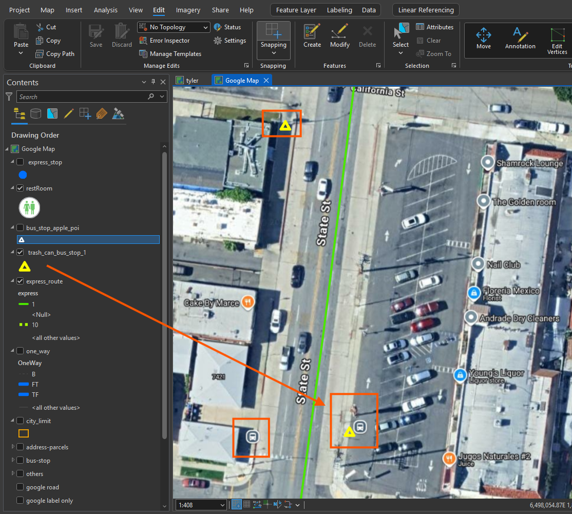
note these address based bus stop is on middle of road,
you have to manually move it to the side of road,
Esri geocoder does not automatically know where is side of road.
Step 12.
Step 13.
Step 14.
Step 15.
Step 16.
Step 17.
Step 18.
Step 19.
Step 20.