Step 1.
Los angeles county does not maintain one way street.
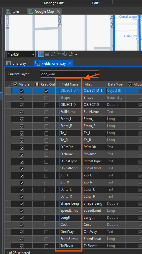
This is Los angeles county street layer attribute table, originally there is no "One way" field name
I manually add "One way" field name as first step.
Step 2.
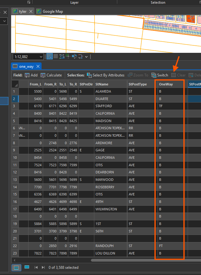
after add "one way" field, this is how I fill it.
B : for both direction.
TF : for To-From ( To means this line end point, From means this line start point)
together To-From means this street allow direction is from this line's end point to start point.
In another word, this street's allowed car flow direction is opposite to this line's digitization direction.
FT : for From-To, again this street's car flow direction is from this line's start point to this line's end point.
In aonther word, car flow direction is same as this line's digitiation direction.
Step 3.
You may ask, why not North, south, west, east as one way value?
First, one way is not always strictly north, south, some time it is 30 degree north-west,
It is difficult use bearing angle to define it. Difficult to measure bearing degree.
Also north, south, bearing angle is human language, only human can read and unstand it.
Computer does not understand what north means.
AI does, but when 20 years ago, ESRI invent this, there is no AI.
How you can let computer understand one way direction?
Computer know when you draw this line, how you draw it from start point to end point.
That is called digitizing direction.
Human know allowed car flow direction.
If digitizing direction is same as car flow direction, you fill it as From-To ( FT )
If digitization direction is opposite from car flow direction, you fill it as To-From (TF)
If both direction, you mark as B
This way, computer based on FT, TF value compare with digitizing direction to calculate car flow direction.
This is very good design by ESRI.
Step 4.
But how do I know car flow direction?
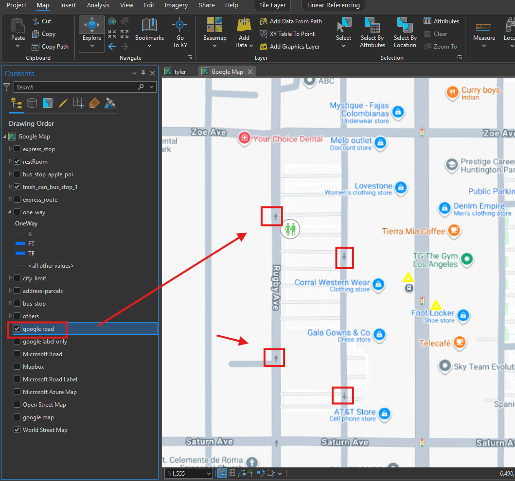
Google street map, Microsoft street map, Here road map, all have car flow direction,
Google map sample
Step 5.
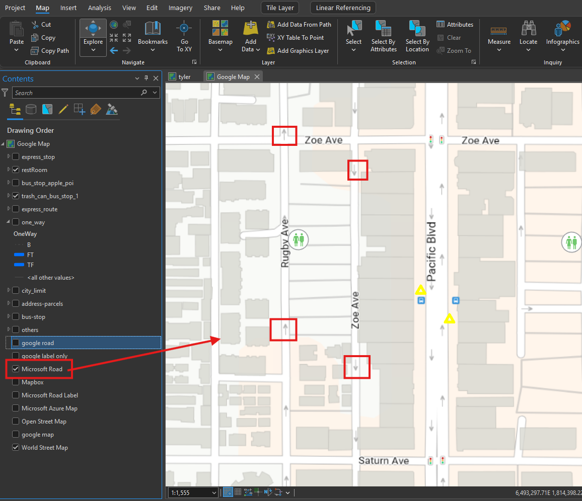
Microsoft Azure map, also have car flow direction
Step 6.
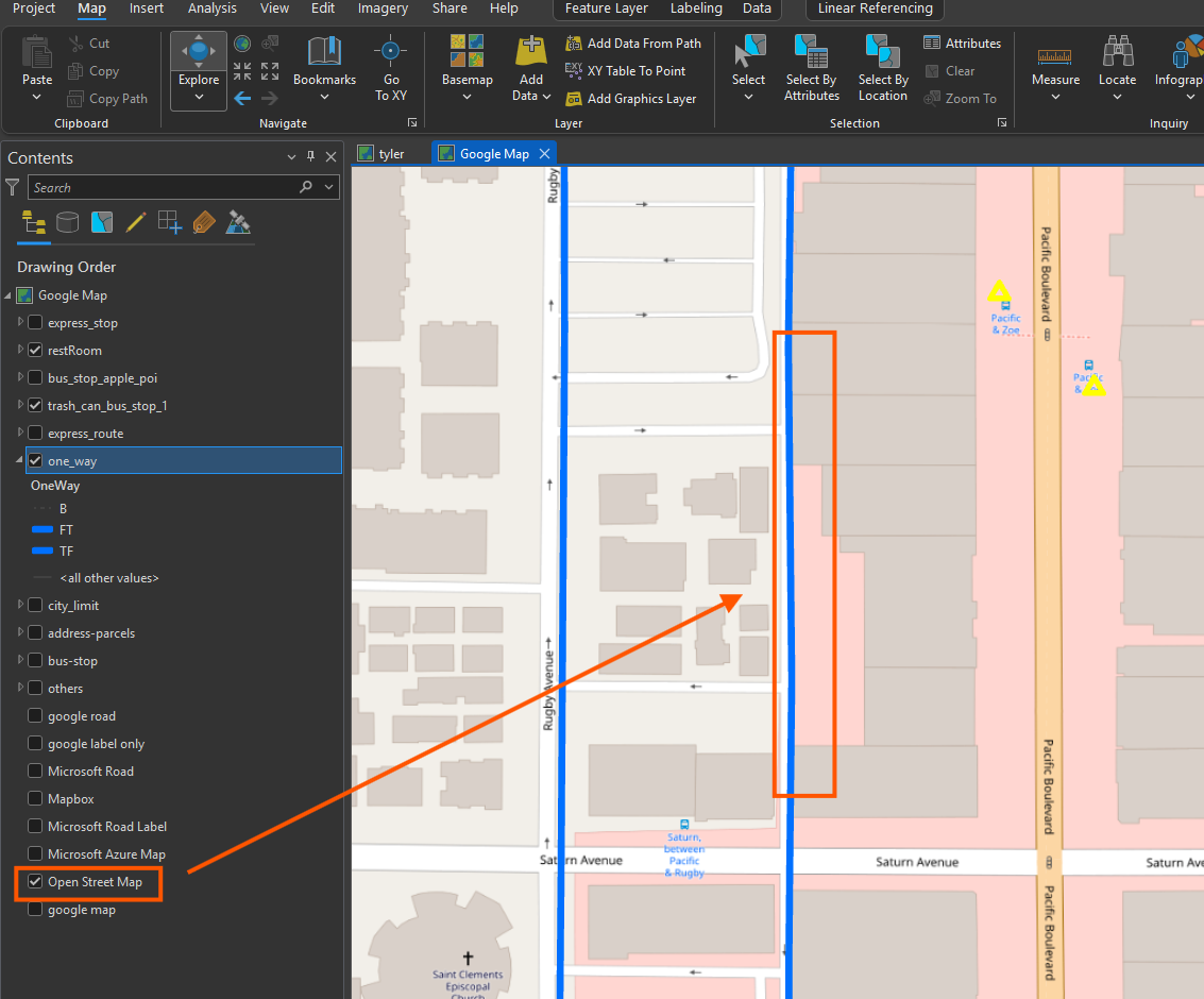
open street map is not reliable, see red box, missing one way arrow.
Step 7.
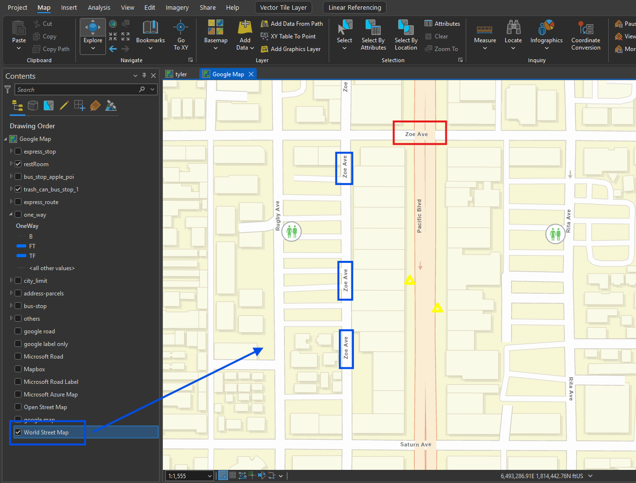
unfortunately, ESRI's street map, is not reliable, in this example,
1) ESRI's map wrongfully mark zoe ave (bliue box are all wrong ),
red box (zoe ave) is where it should be.
2) blue box should be one way arrow, ruby ave also missing one way arrow
Step 8.
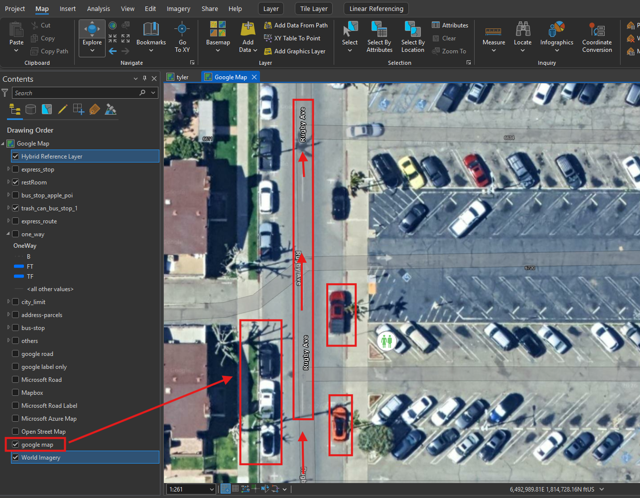
google satellite map also allow you to see car position and wether it have yellow solid line.
Ruby ave is one way, because there is no yellow solid line or dash yellow line
car postion tell me this street allow car flow direction is from south to north
Step 9.
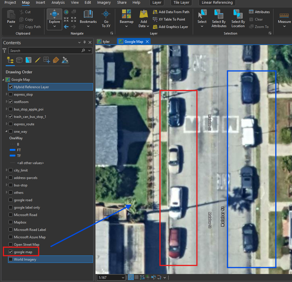
google map, from parking car position, you can tell this is both way direction
Step 10.
ESRI's map also works, but I can barely see parking direction, I like google much better than ESRI.
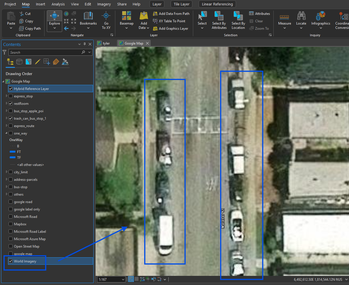
Step 11.
NearMap even better than google, not only see car parking direction, also see car color,
car type, truck, van, SUV, seden also can be recognize
but it is not free, have to pay subscription fee annually
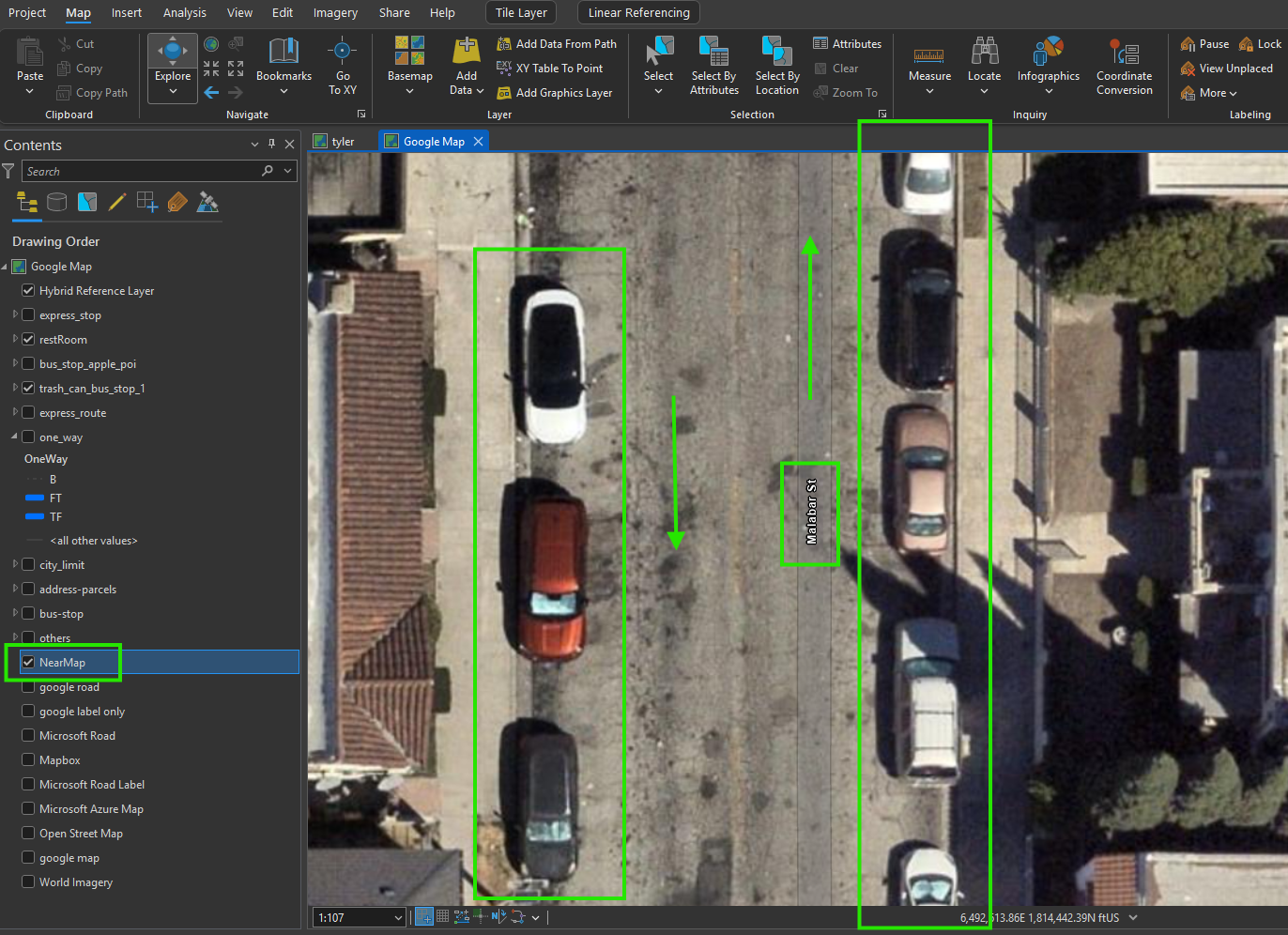
Step 12.
so far, you know car flow direction, but you still don't know street line digitization direction.
Step 13.
Step 14.
Step 15.
Step 16.
Step 17.
Step 18.
Step 19.
Step 20.