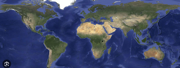
Today WGS1984 is all your need But If you just use iphone browse google map, WGS1984 is all you need.
If you are gis analyst, you are not likely use WGS1984,
You are likely use state plan coordinate system.If you work for different city, you will use different coordinate system.
For Los Angeles, you will use CA-zone-5
For plam springs, you will use CA-zone-6, and so on
If you work for air force, navy, you will use MGRS grid coordinate system
If you work for NOAA, USGS,
you will use national grid coordinate system
I can keep going thousands of coordinate system use case
why every one use its own coordinate system
instead of just WGS1984 ?
1). historically
Current existing coordinate system evolved at least 400 years, They are way before WGS1984. Historic people don't have satellite don't have GPS, they can't get Latitude,Longitude WGS1984 is lat,long based without GPS, WGS1984, does not make sense Historically they developped different coordinate systems to best fit their own need at the time.Now when you process historic data, you have to use theirs coordinate system. Can you convert their coordinate system into WGS1984 ?Yes, but no one want do that, huge amount of work make no sense. Paper map no way to change.Keep using conventional coordinate system is most likely you will do today.
2) technically
Military use MGRS coordinate system has a reason,for example you are F35 pilot, you need report your location over the radio signal.it is not likely read wrong if you read MGRS 18S UJ 2345 6789Otherwsie if you use WGS1984, you will read, latitude:39.44248400, longtitude:-77.05163258 MGRS has letter and number in fixed formate, 13 digital WGS1984, are all number, 20 digital long, one digital miss read, will get wrong.
Where to find what coordinate system they used?
For example Los Angeles
https://transparentgov.net/json2tree/esri/server/folder.html?org=https%3A%2F%2Fpublic.gis.lacounty.gov%2Fpublic%2Frest%2Fservices&url=https%3A%2F%2Fpublic.gis.lacounty.gov%2Fpublic%2Frest%2Fservices&arcgis_online_token=&timeout=9000&select_folder=18&select_layer=18&select_folder_text=Political_Boundaries+%3Csup%3EMapServer%3C%2Fsup%3E&select_layer_text=18+%26%23x21E2%3B+County+Boundaries+%3Csup%3EFeature+Layer%3Csub%3E+esriGeometryPolygon%3C%2Fsub%3E%3C%2Fsup%3E
Los Angeles use CA-zone-5
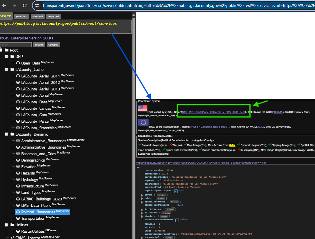
Los Angeles use CA-zone-5
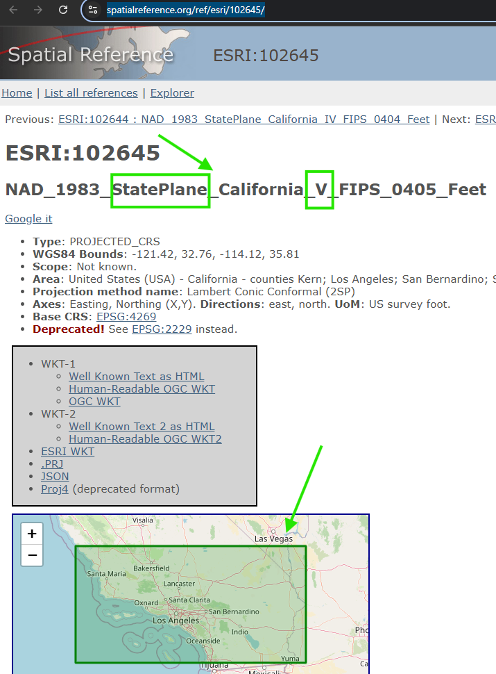
https://spatialreference.org/ref/esri/102645/
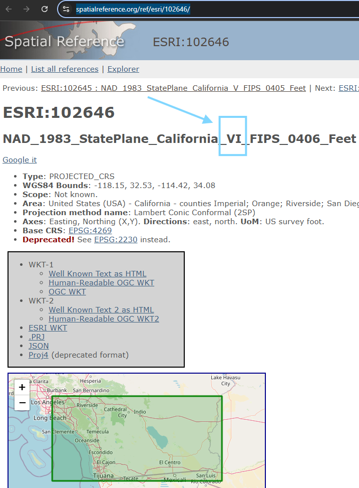
La Quinta will use CA-zone-6
https://transparentgov.net/json2tree/esri/server/folder2.html?url=https%3A%2F%2Fgis.la-quinta.org%2Farcgis%2Frest%2Fservices&org=La+Quinta+CA&_center_lat=33.6634&_center_long=-116.31&_center_zoom=17&select_folder=30&select_layer=1&arcgis_online_token=&select_folder_text=school_districts+%3Csup%3EMapServer%3C%2Fsup%3E&select_layer_text=1+%26%23x21E2%3B+City+Boundary+%3Csup%3EFeature+Layer%3Csub%3E+esriGeometryPolygon%3C%2Fsub%3E%3C%2Fsup%3E
click coordinate system link
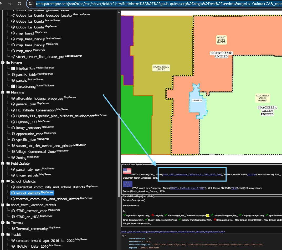
La Quinta will use CA-zone-6
https://spatialreference.org/ref/esri/102646/
Step 1.
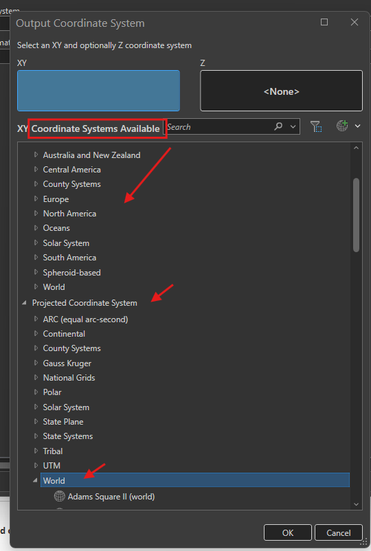
ESRI can convert, transform, re-project thousands of coordinate system,
But do you really need more than one coordinate system?
Step 2.
NO, you do not.
You only need one 3857( projected) - 4326 ( geographic)
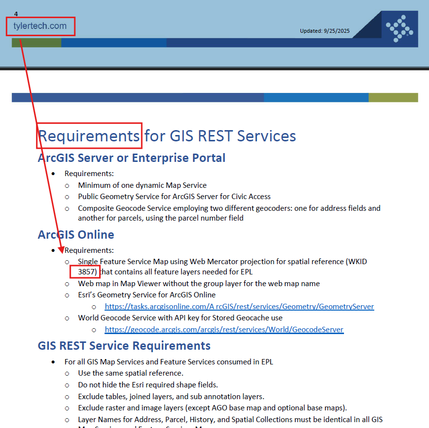
This is tyler software gis requirement.
Tyler cloud service EPL processing a few thousands of cities's gis data in US
They require all cities use single one coordinate system 3857
3857(4326) is for world use,
google map, apple map, any online map, mobile map is using 3857
Step 3.
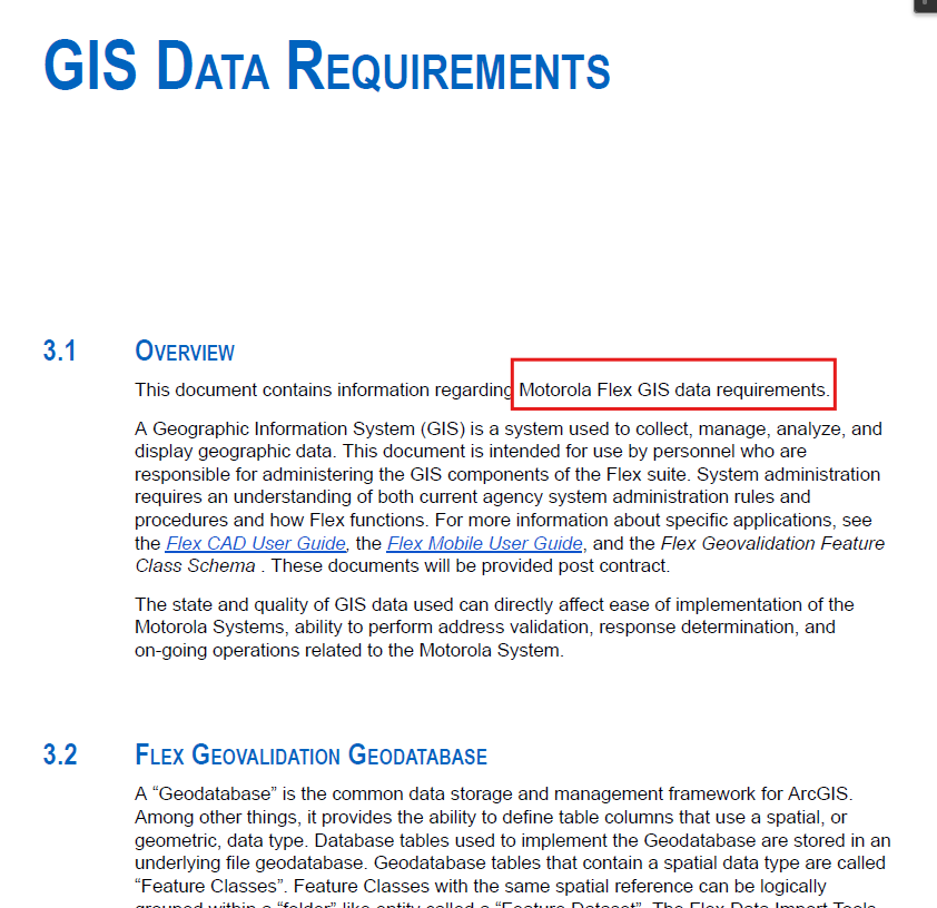
Flex processing several hundreds of police department gis data in single one coordinate system 3857
Step 4.
Because different law enforcement use different coordinate system,
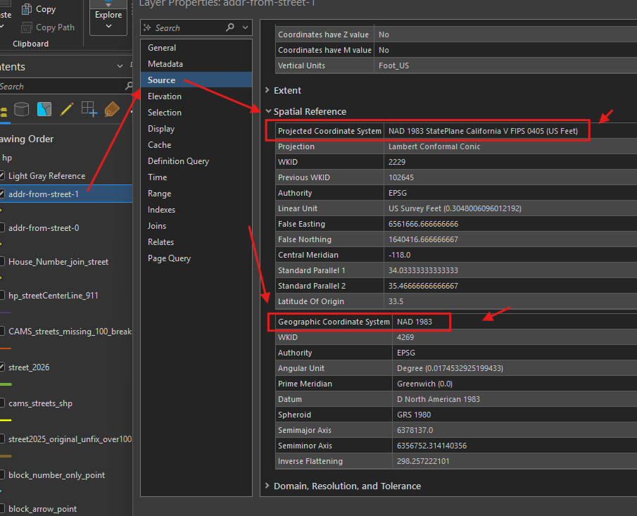
for example, los angeles county will use:
california zone 5
Why you see 2 different coordinate system here ?
Step 5.
projected coordinate system and geographic coordinate system are in pair.
geographic coordinate system is virtual,
it is how you are going to design the coordinate system.
it is sphere, unit is angle in degree.
projected coordinate system is reality,
you can choose a specific method to project sphere on the flat surface,
it is flat surface unit is length, meter or feet
Step 6.
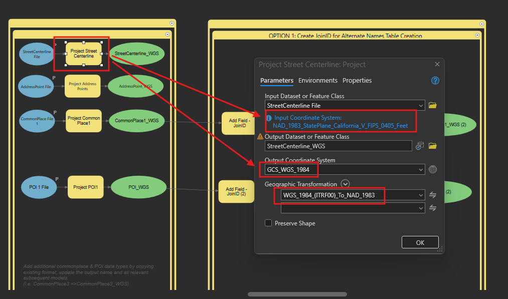
Flex use ESRI's tool to convert from other coordinate system( in my case, it is california zone 5, ) to 3857.
Step 7.
why you need 2 coordinate system in pair ?
projected-3857 ( geographic-4326 )
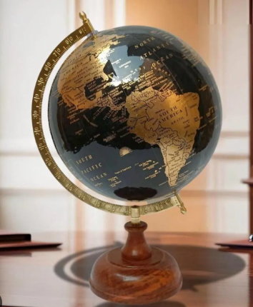
Because the earth is a sphere, not flat,

You have to use sphere based coordinate system ( which is geographic - 4326)
Step 8.
while you computer screen, your iphone screen is flat, (not sphere)
to display a earth(sphere) on flat screen
you will have to use specific method to project sphere onto flat surface.
projected-3857 is flat, it is the result of you project sphere-4326.