Why I make free shape file online viewer?
Short : I google search, but can't find one.
Long story : Shape file is a proprietary file format owned by ESRI. Technically you have to have ESRI license and use ESRI software to open it. Since most of public user don't have those cost of several thousands dollars ESRI license. They don't have ArcGis Pro software installed. When they get a shape file, they can't open it. ( QGIS is a free option, but they have to install it and know how to use QGIS to load shapefile, it is too hard for most of public user. )
if you want to open shape file without a ESRI license and software. Here is rescue.
How to View Shapefile by Upload a zipped shapefile to
Option 1
show layer's original color on Esri map, support multiple layer, multiple shapefile zipped into single xx.zip
https://developers.arcgis.com/javascript/latest/sample-code/layers-featurelayer-shapefile/
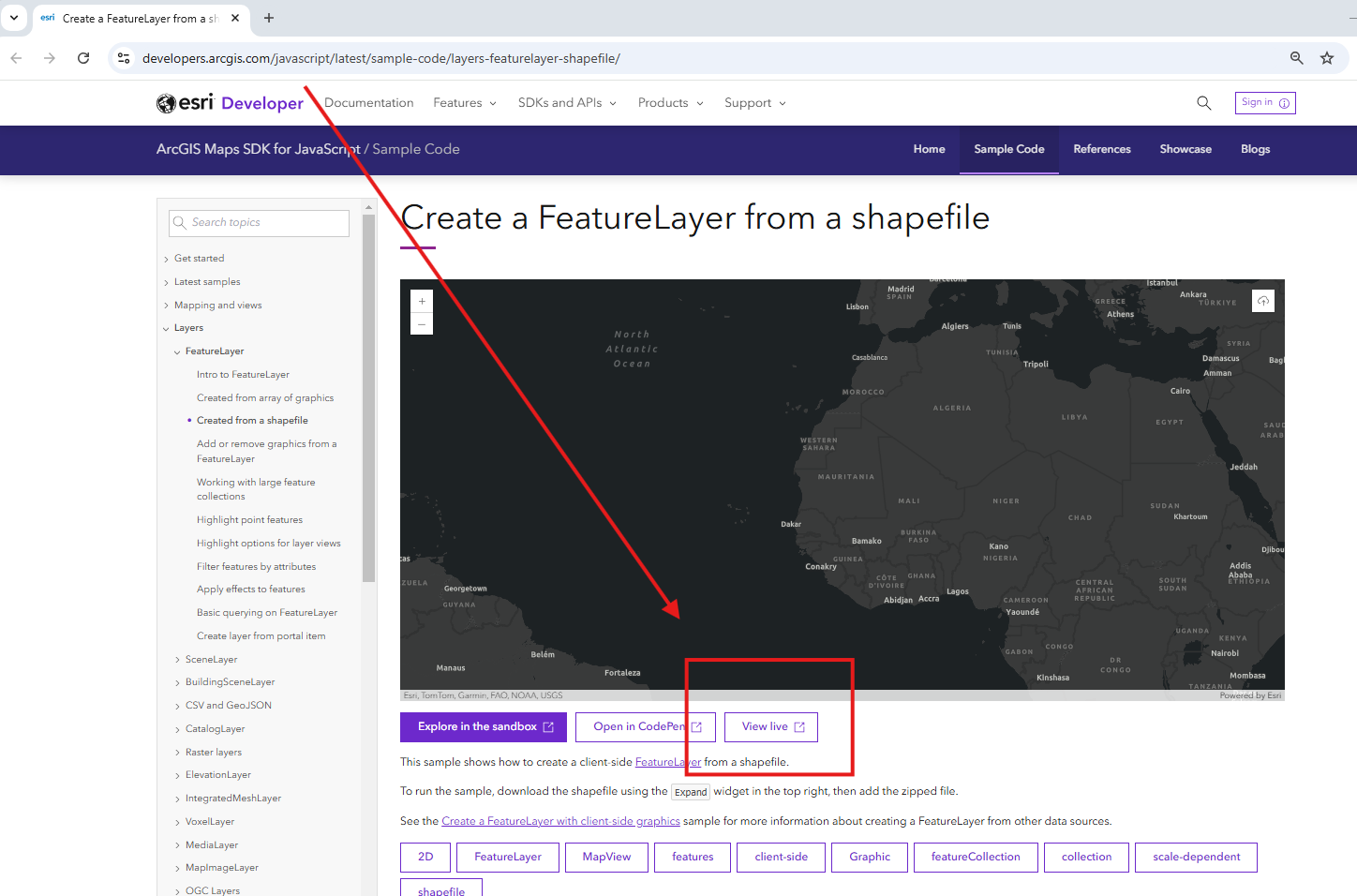
Step 1. click live sample or any other 2 buttons
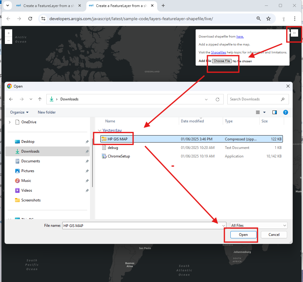
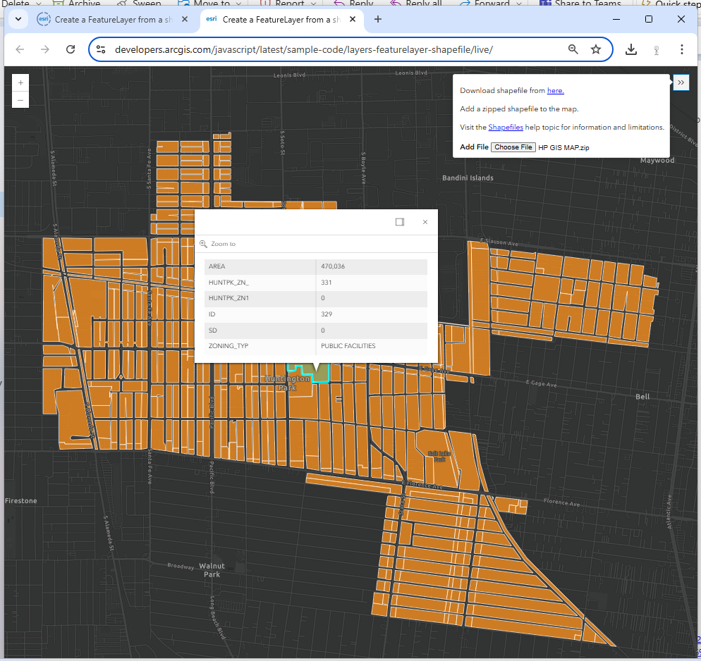
Step 2, upload a zipped shapefile
https://developers.arcgis.com/javascript/latest/sample-code/layers-featurelayer-shapefile/live/
Step 3, shapefile will display at here
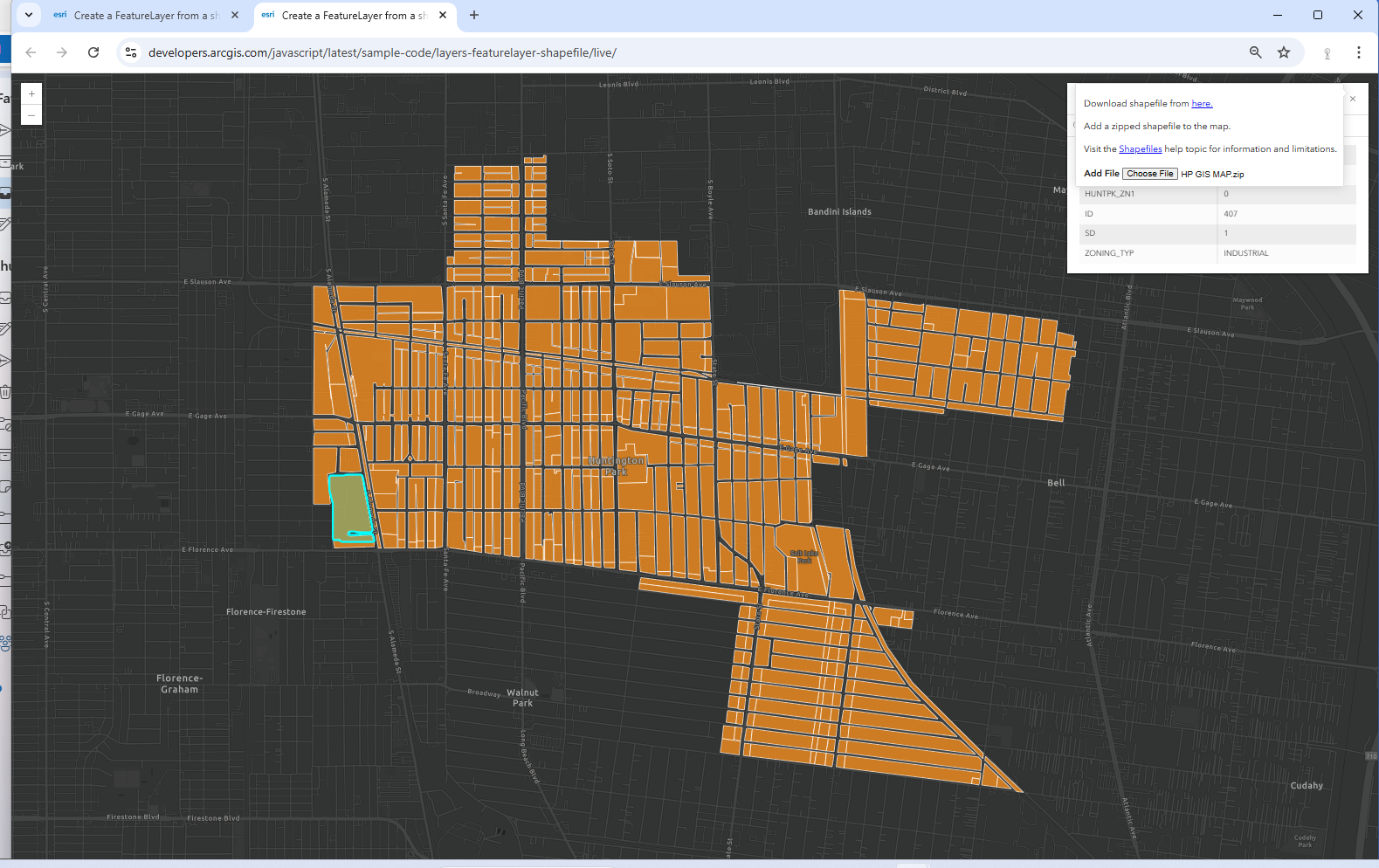
Step 4, click a polygon, attribute info will popup
Option 2
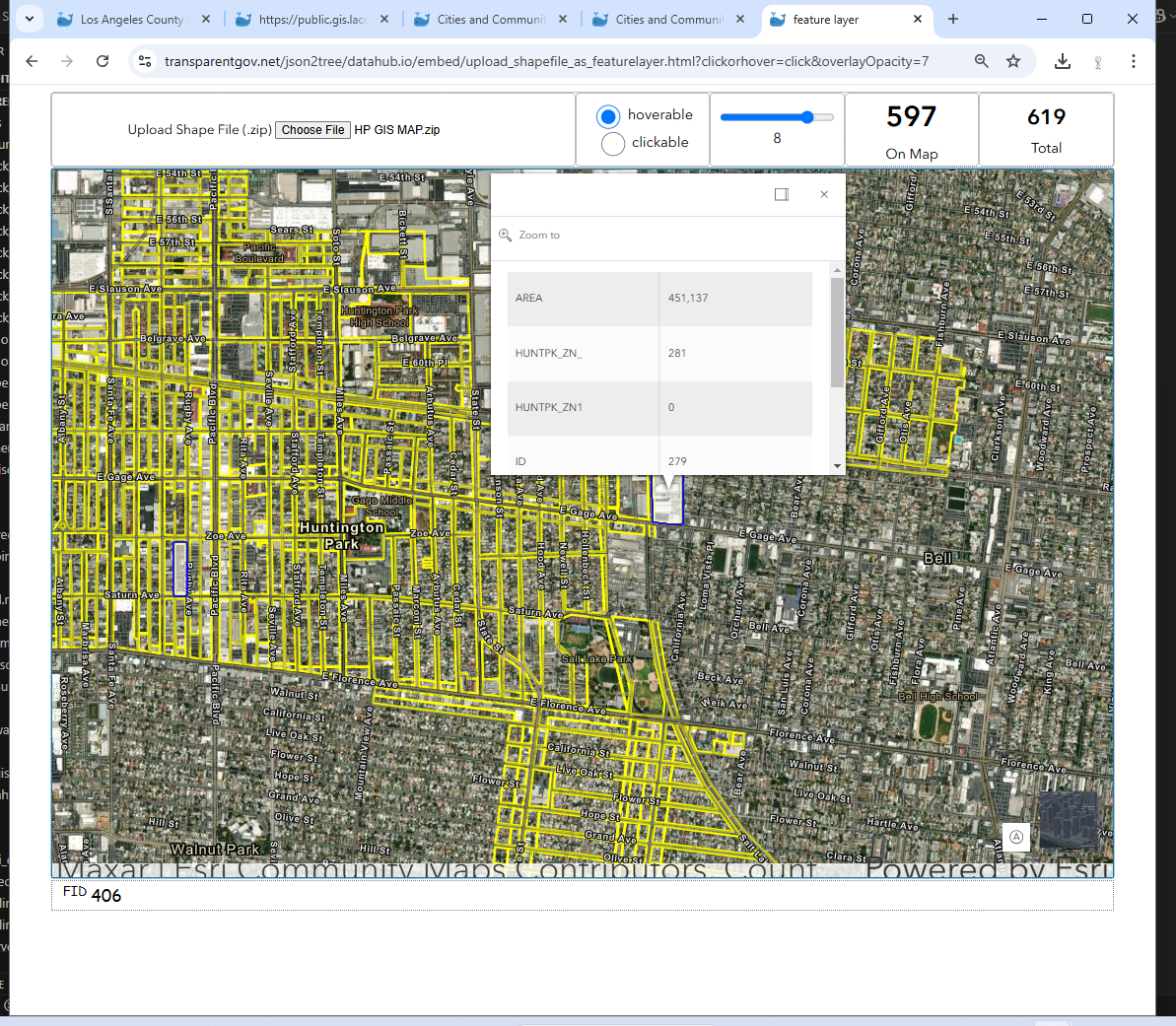
Enforce Yellow Line overwrite layer's original color on Esri map, support multiple layer, multiple shapefile zipped into single xx.zip
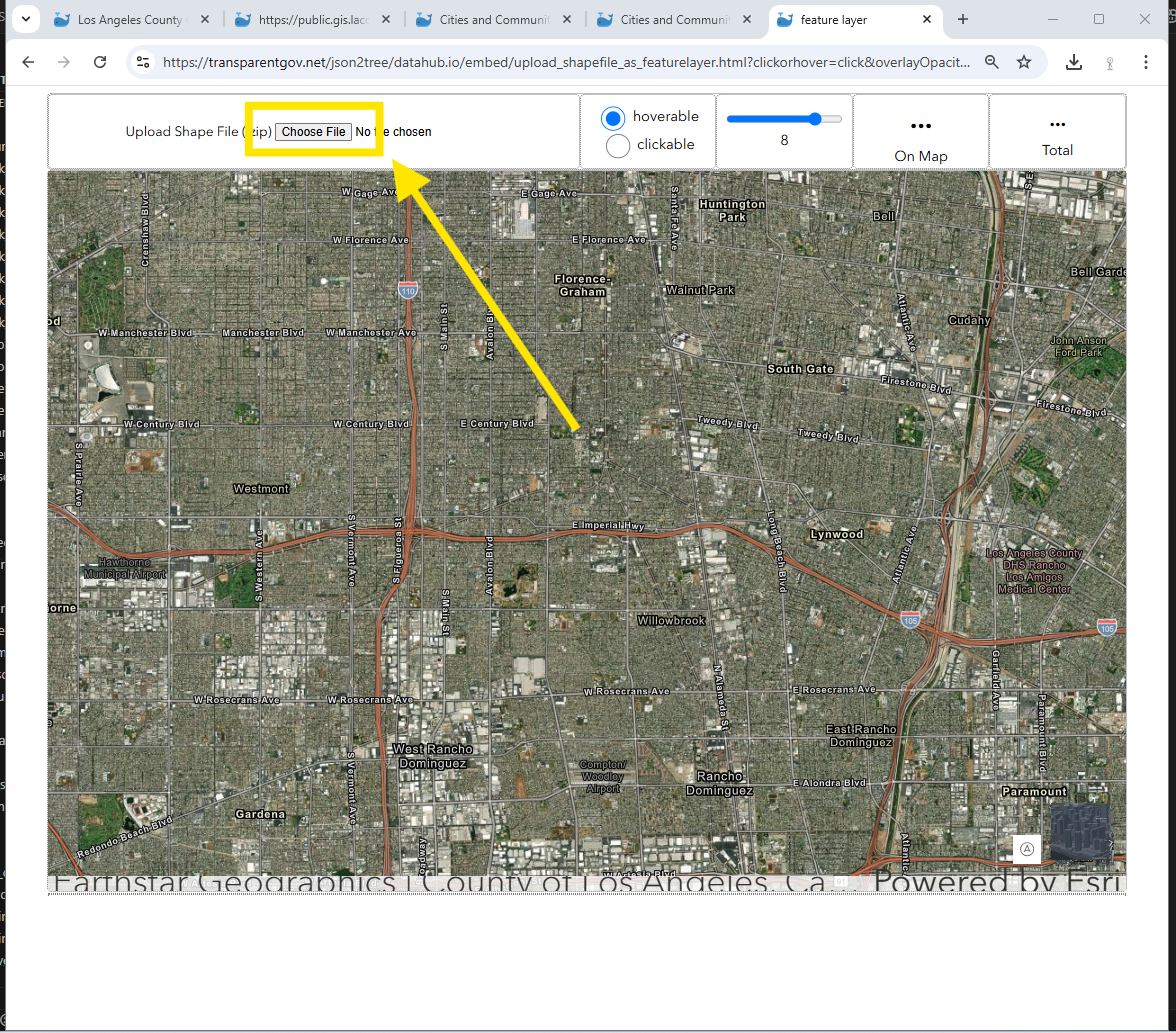
Step 1. click choose file button to upload xxx.zip (shapefile)
https://transparentgov.net/json2tree/datahub.io/embed/upload_shapefile_as_featurelayer.html?clickorhover=click&overlayOpacity=7
Step 2. after uploading completed, click polygon, popup window will show details
Option 3
View remote shapefile(URL) or local shapefile( xxx.zip) on Google Map, multiple layer not supported. Only single shapefile, single layer supported.
Current support "single_shapefile.zip" at a time, "multiple_shapefile.zip" will be support in future
https://transparentgov.net/json2tree/gateway/shp.viewer.html
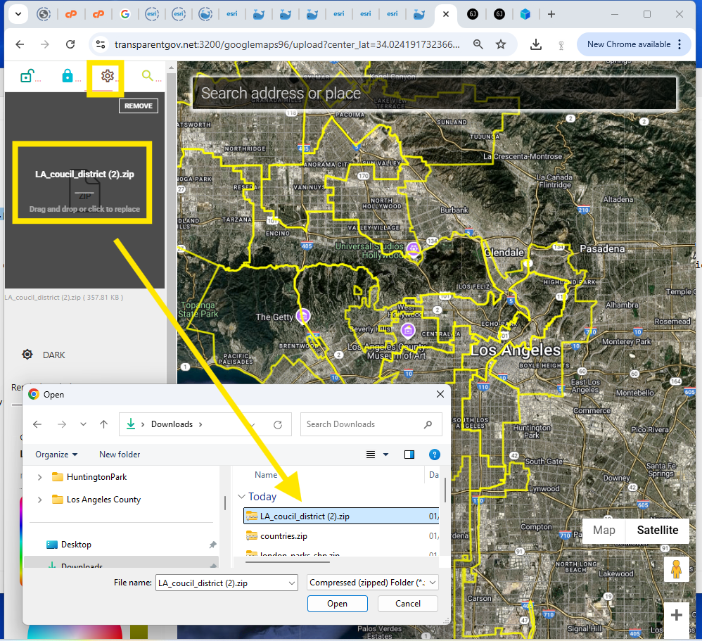
Upload a zipped shapefile to google map click here
https://transparentgov.net:3200/googlemaps96/upload
