How to publish map service use original projection as shape file source on arcgis server?
Step 1:
ArcMap --> File --> Share as --> service
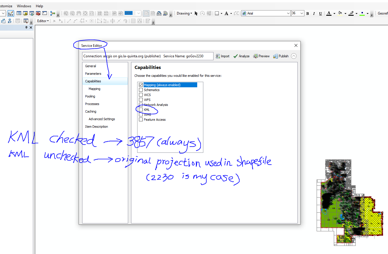
Service Editor --> click Capabilities --> uncheck the KML check box
Step 2:
ArcMap --> File --> Share as --> service
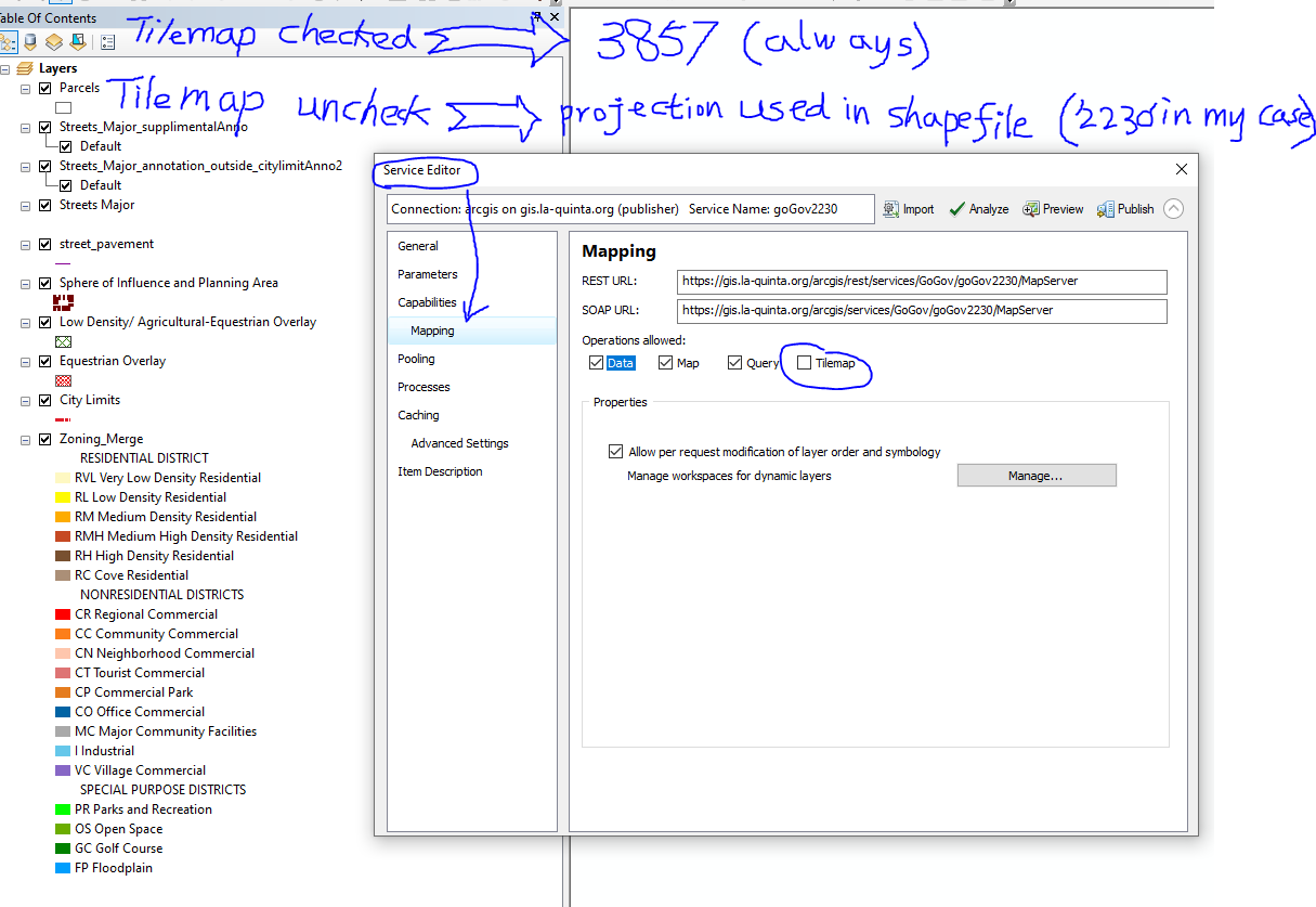
Service Editor --> click mapping --> uncheck the tiledMap check box
Let's look details by example:
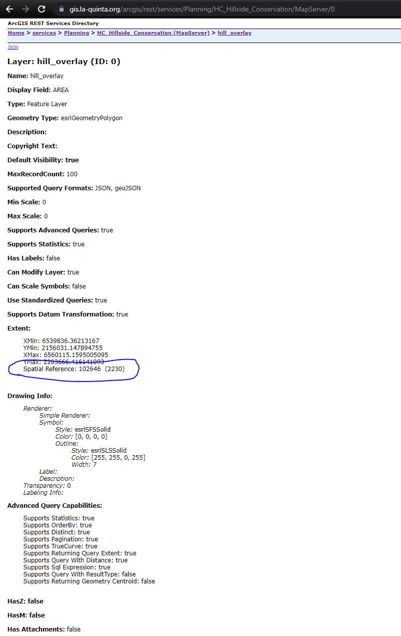
The published rest service projection is the same as your source data projection. For example, I have a shape file use projection 2230 ( state plan california zone 6) , if I publish it on arcgis server, rest service will use 2230 as projection.
see this example: 2230
https://gis.la-quinta.org/arcgis/rest/services/Planning/HC_Hillside_Conservation/MapServer/0
However, popular online map use different projection
https://gis.stackexchange.com/questions/48949/epsg-3857-or-4326-for-googlemaps-openstreetmap-and-leaflet
Google Earth is in a Geographic coordinate system with the wgs84 datum. (EPSG: 4326)
Google Maps is in a projected coordinate system that is based on the wgs84 datum. (EPSG 3857)
The data in Open Street Map database is stored in a gcs with units decimal degrees & datum of wgs84. (EPSG: 4326)
The Open Street Map tiles and the WMS webservice, are in the projected coordinate system that is based on the wgs84 datum. (EPSG 3857)
EPSG: 4326 uses a coordinate system on the surface of a sphere or ellipsoid of reference.
EPSG: 3857 uses a coordinate system PROJECTED from the surface of the sphere or ellipsoid to a flat surface.
Think of it as this way:
EPSG 4326 uses a coordinate system the same as a GLOBE (curved surface). EPSG 3857 uses a coordinate system the same as a MAP (flat surface).
EPSG:4326 is in degrees - 3D sphere
EPSG:3857 is in metres - 2D projection
If I say Paris is:
A) Lat(48.8589506) Lon(2.2768485)
B) Lat(6250962.06) Lon(253457.62)
Given a choice of the two SRIDs above
A) is clearly in degrees, the numbers are small and there's loads of decimal places (48m from equator/2m from greenwich meridian would make Paris a tropical GMT+0 place, but my general knowledge says Paris is temperate and on CET) so SRID is 4326
B) both values are well over the max value for the unit to be degrees, it must be metres so the SRID is 3857
NB I used this site to convert 4326 to 3857 and also note this only helps if you know if it's either 3857 or 4326, there are loads of SRIDs, some measure in radians/feet etc and units aren't the only way they differ
How to publish map service as WGS_1984( 3857 ) on arcgis server?
Step 1:
ArcMap --> File --> Share as --> service
Service Editor --> click Capabilities --> check the KML check box
Step 2:
ArcMap --> File --> Share as --> service
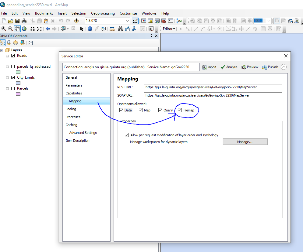
Service Editor --> click mapping --> check the tiledMap check box
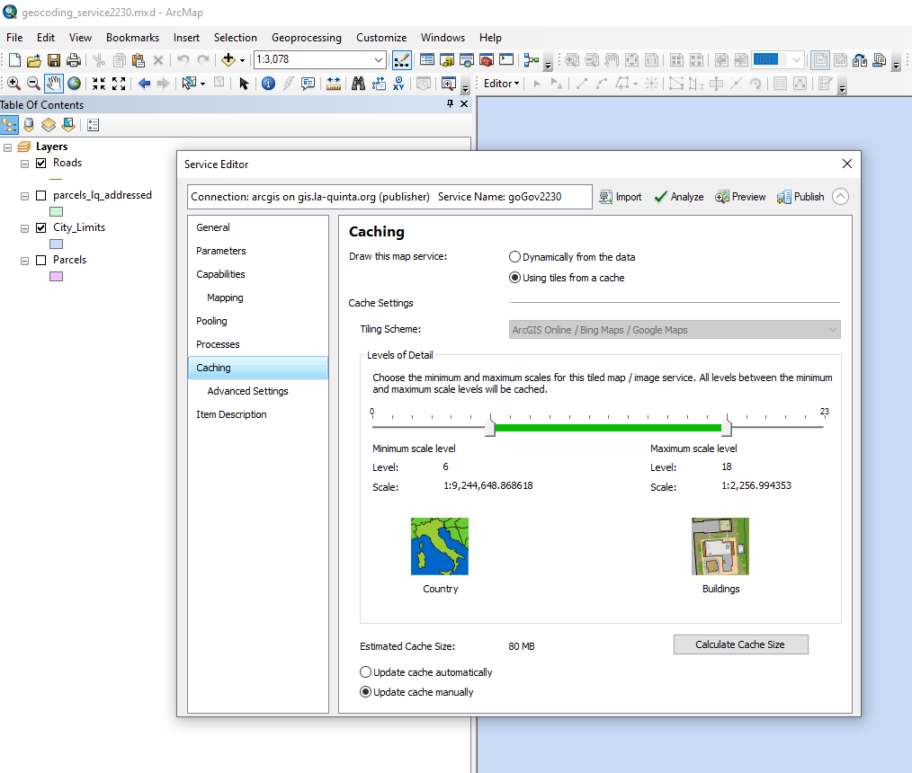
By default, it is unchecked. You will get a state plan projection for your map service on arcgis server.
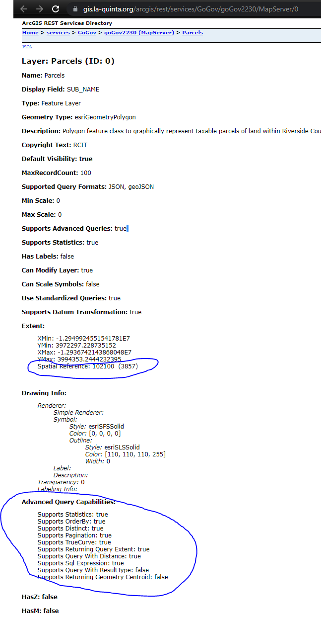
See this example, use 3857
https://gis.la-quinta.org/arcgis/rest/services/GoGov/goGov2230/MapServer/0
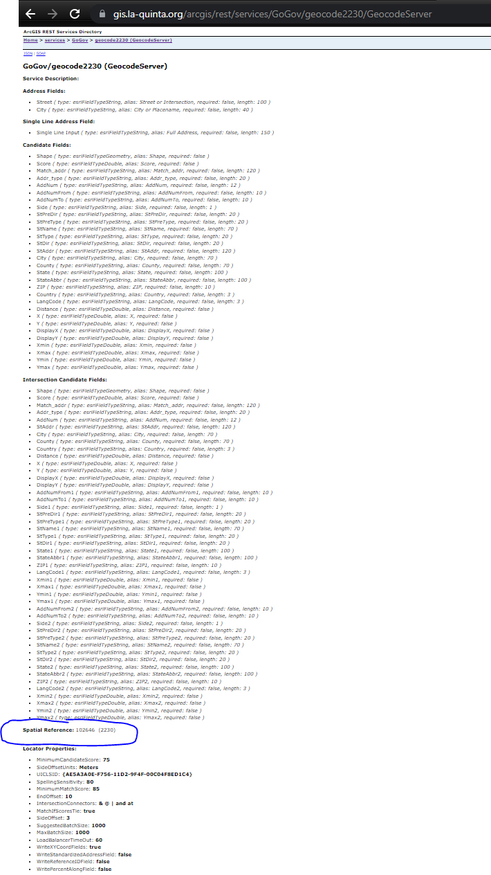
Geocoding Server is different story.
If my reference Roads layer is 2230, I create a address locator, then I publish it as geocoding service, I always get a 2230 on geocoding service.
https://gis.la-quinta.org/arcgis/rest/services/GoGov/geocode2230/GeocodeServer
If I want a 3857(wgs_1984) geocoding service, what I do?
Easy, first you should re-project your reference Roads layer from 2230 to 3857 use arcTool box, data management tool, project.
Then you create a address locator, then publish it, you will get a 3857 geocoding service.