Use file geodatabase or any other type of geodatabase as source
do not use shape file as source.
why?
1). Use file geodatabase or any other type of geodatabase as source, give your arcgis REST api, Advanced Query Capabilities, following item are "true":
Supports Advanced Queries: true
- Supports Statistics: true
Supports OrderBy: true
Supports Distinct: true
Supports Pagination: true
Supports TrueCurve: true
Supports Returning Query Extent: true
Supports Query With Distance: true
Supports Sql Expression: true
Supports Query With ResultType: false
Supports Returning Geometry Centroid: false
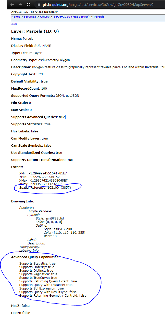
You can find it at this example: file geodatabase as source
https://gis.la-quinta.org/arcgis/rest/services/Planning/zoning/MapServer/7
This example need pagination, it works since its source is file geodatabase.( it will not work in the next example with shape file as source )
Click here open full screen in a new tab
2). Shape file as source, your arcgis REST api, will not support Advanced Query Capabilities, following are "false":
Supports Advanced Queries: false
Advanced Query Capabilities:
- Supports Statistics: false
Supports OrderBy: false
Supports Distinct: false
Supports Pagination: false
Supports TrueCurve: true
Supports Returning Query Extent: true
Supports Query With Distance: true
Supports Sql Expression: false
Supports Query With ResultType: false
Supports Returning Geometry Centroid: false
You can find it in this example: Shape file as source.
https://gis.la-quinta.org/arcgis/rest/services/Planning/opportunity_zone/MapServer/4
This example will not work, because shape file as source, not support advance query, not support pagination.
Click here open full screen in a new tab