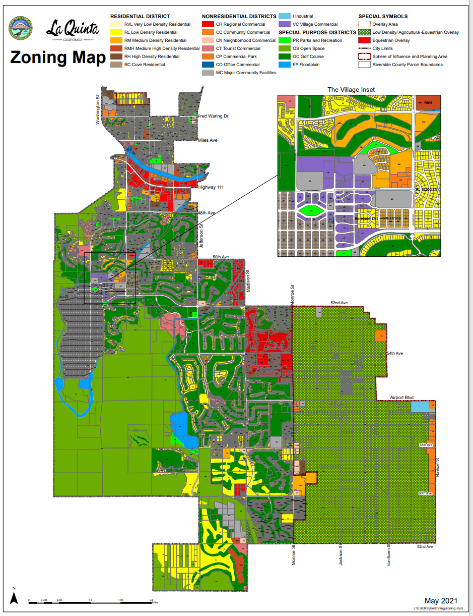
This kind of standard zoning map has max entropy value "1".
Means it has has max 'chaos', max 'surprise', max 'uncertainty'
So many heterogeneous layers and heterogeneous model mixed together.
It is not easy to read, not easy to digest, Since the map is too "busy".

Let's reduce the entropy, increase the information gain.
Let's split it by column "zone name".
In decision tree theory, you can calculate each entropy of split it by each column.
This example reduce the entropy down to "0", you get the max information gain.
You feel much easier to read, much easier to digest. Since each time you only get homogeneous item. They all have the same zone name.
Click here to open in a new tab --- Classified Sample ---
One layer, one model each time, the entropy is 0. Since all item are homogeneous. No chaos, No surprise.
More layers you added, entropy will increase towards 1.
More layers added, busier the map, harder to read, harder to digest for user.
want to see more ?