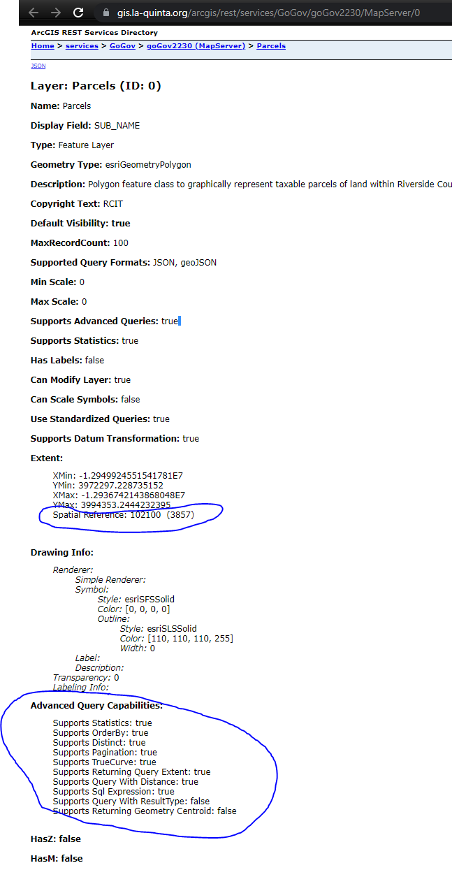
Sample use 3857 (WGS 1984) , which is not the same as source
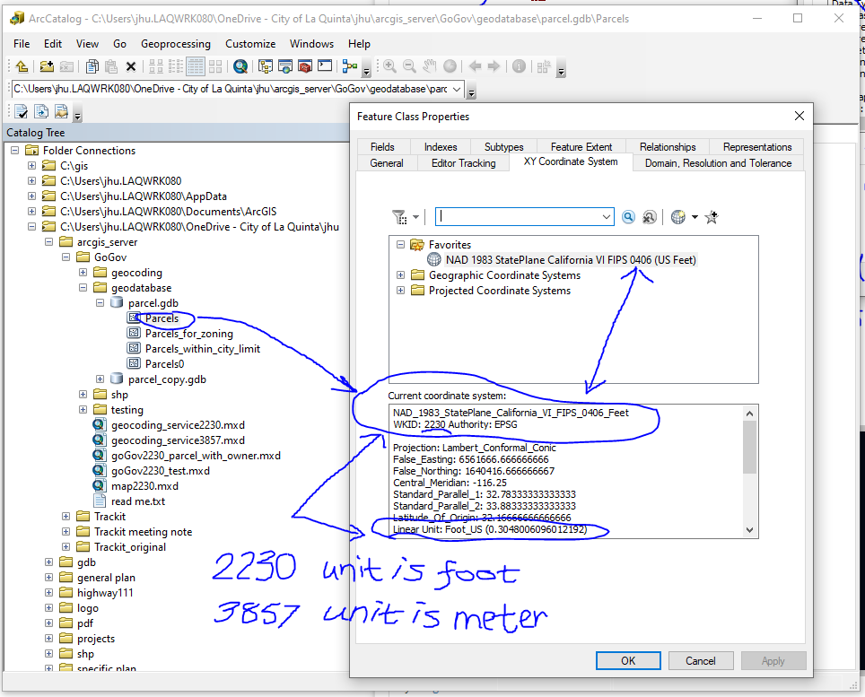
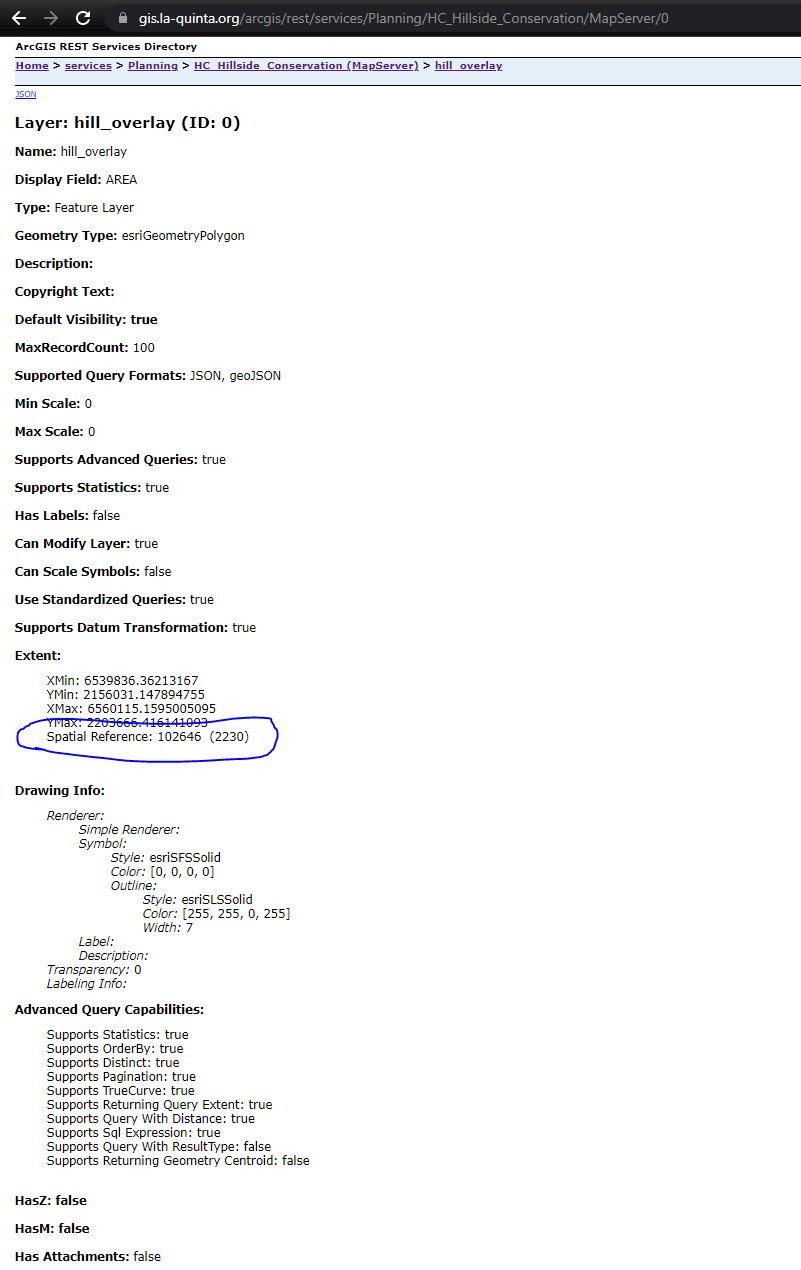
Sample use 2230, which is same projection as source
How to publish map service use original projection as shape file source on arcgis server?
Step 1:
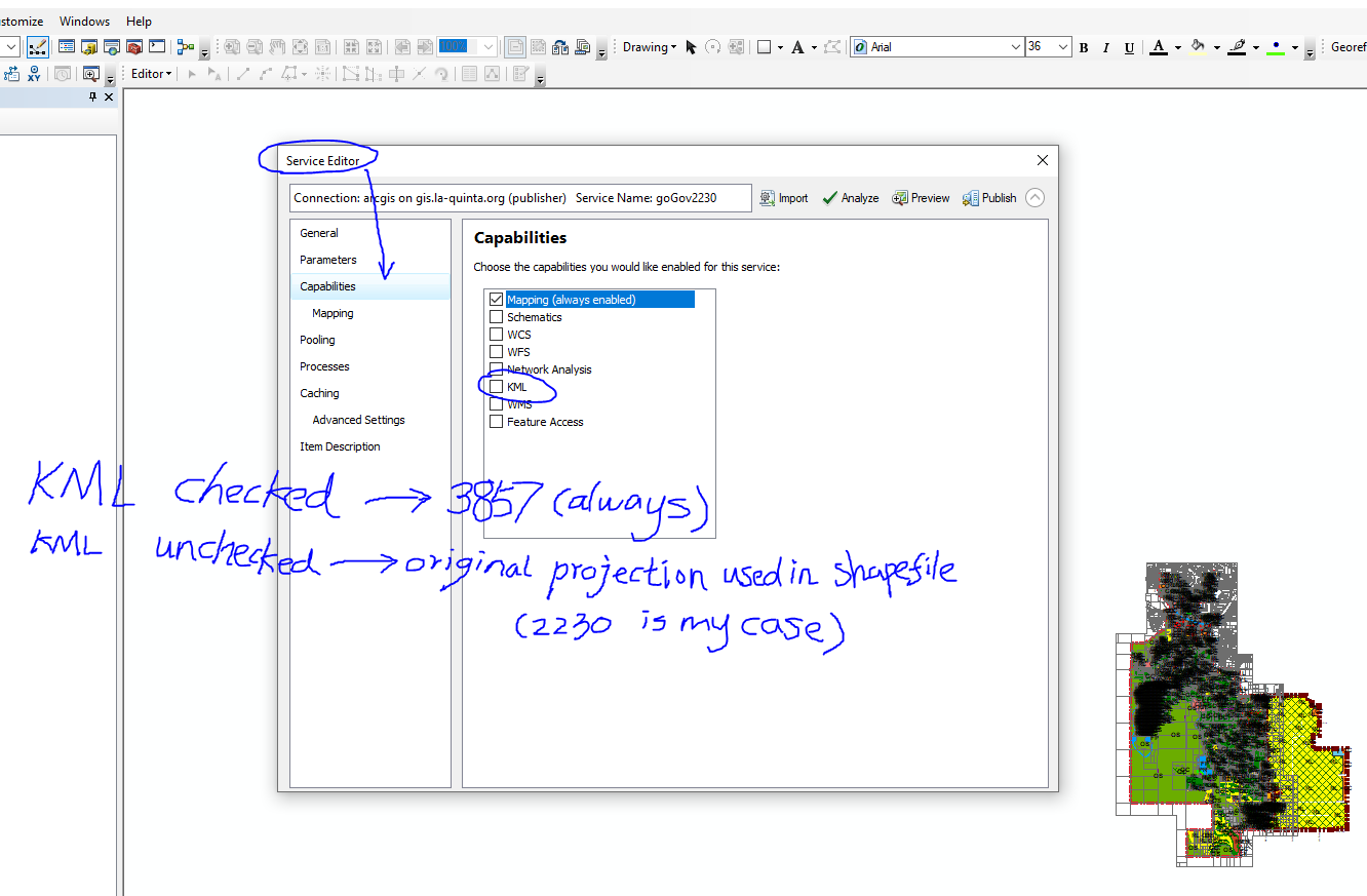
ArcMap --> File --> Share as --> service
Service Editor --> click Capabilities --> uncheck the KML check box
Step 2:
ArcMap --> File --> Share as --> service
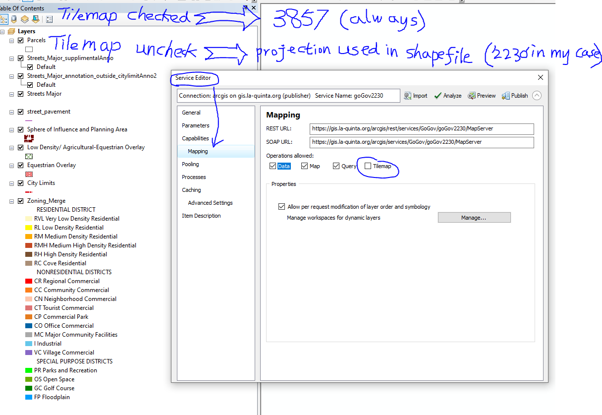
Service Editor --> click mapping --> uncheck the tiledMap check box
Step 3:
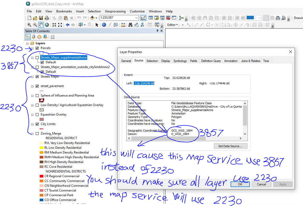
Make sure all layers have same projection 2230 (in my case). If one or many of the layers use different projection WGS1984 (3857), the mixed projection will result into all layers service use 3857.
If all layers use 2230, the final rest service will use 2230
If some layer use 2230, some use 3857 (WGS1984), the final rest service will use 3857, NOT 2230.
The more tricky part is if you mixed projection, result in 3857, even if you removed all layers with 3857, you publish again, you still get 3857, you will not get 2230 as you desired.
I know 'how', but I don't know 'why'
This is 'How'
If you accidently mixed projection and resulting into 3857 and if you want to go back to 2230,
< 1 > You must use a different map service name as the 3857 one. The old service name will for ever use 3857 no matter what you do.
<2> Remove all the layers that use WGS1984(3857)
<3> Publish again following above step 1) and 2) with a different map service name as <1> point out.
<4> Done, you will have a new map service with 2230.
'Why' you remove all 3857 layers, when publish, you still get 3857?
This the "why" I don't know
2230 is state plane california zone 6, unit is foot, while 3857 unit is meter.