read step by step
GoGov parcel update
https://transparentgov.net/cleargov1/914/gogov-parcel-update?show=914#q914
1) download unzip ParcelAttributedwOwner0622.zip
2) select by loacation, intersect with city limit
3) export
4) add 'street_no' (text) column
GoGov only use 2230, NOT work with 3857
always publish map as 2230, no tile, no cache, dynamic only
parcel attribute always add 'street_no' (text) column
BaseMap : 2230 , no tile cache
BaseMap1: 3857 , tiled cache
geocoding only use 2230, not use 3857
Arcmap, customize > toolbar > geocoding you should see a floating geocoding bar open in another screen.
select your address locator, type address '78495 CALLE TAMPICO La Quinta' click enter, tool tip should say address not found or full address, means success.
How to creat a new address locator:
arccatalog:
C:\Users\jhu.LAQWRK080\OneDrive - City of La Quinta\jhu\arcgis_server\GoGov\geocoding
right click > new > address locator
address locator style: choose : us address dural range
reference data: choos : Roads.shp
riverside county roads.shp bug:
in the field map, must reselect match:
Suffix Type should match to : Street_suf
the other field are ok, no need to change.
leftcity and rightcity must match field, without match field, would not work.
How to publish a new address locator:
arccatalog:
right click Roads_AddressLocator2 > share as > Geocode service
youtube:
How to Geocode Provider Addresses Using ArcGIS https://www.youtube.com/watch?v=_5Q39M41JGI&t=269s
improvement:
Skip city name:
- Address validation for single line input requires the city name, it should not. Example '78495 CALLE TAMPICO La Quinta' validates however '78495 CALLE TAMPICO' does not.
Solution:
ArcCatalog, right click Roads_AddressLocator2 > properties > Geocoding options > Match with no zones > choose YES, (default is NO)
This will allow you skip city name in address.
spatial reference by default use : 3857, when click tiledMap, will auto use 3857
if not click tiledMap, will auto use original spatial reference 2230, (state plane california zone 6)
max return feature count limit: 100
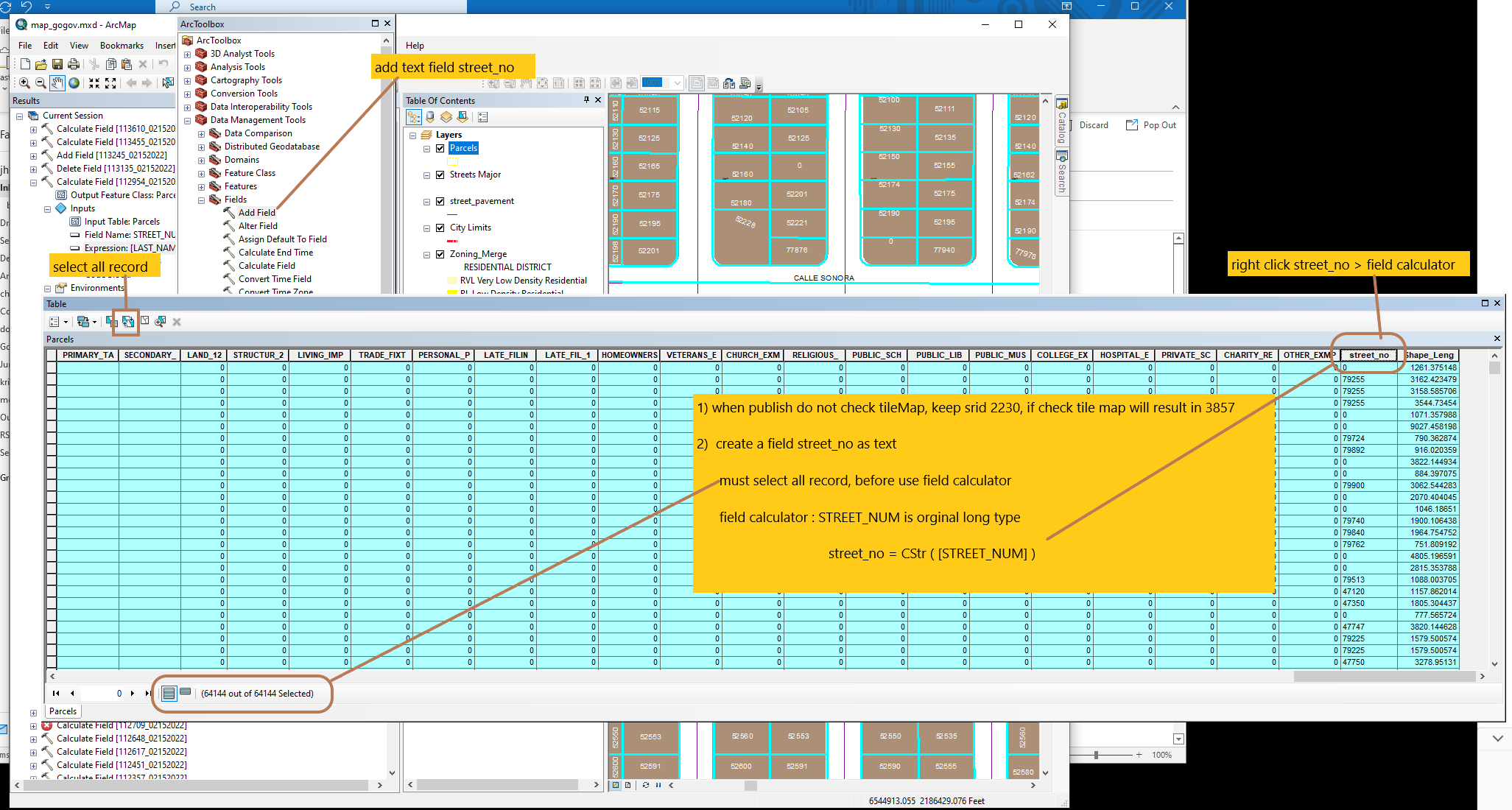
1) when publish do not check tileMap, keep srid 2230, if check tile map will result in 3857
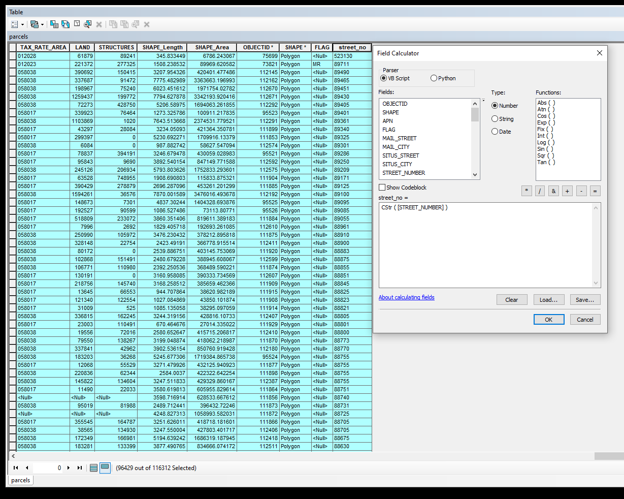
2) Only apply if use file geodatabase. SQL server based enterprise geodatabase will automatically cast number to string. No need following operation.
create a field street_no as text
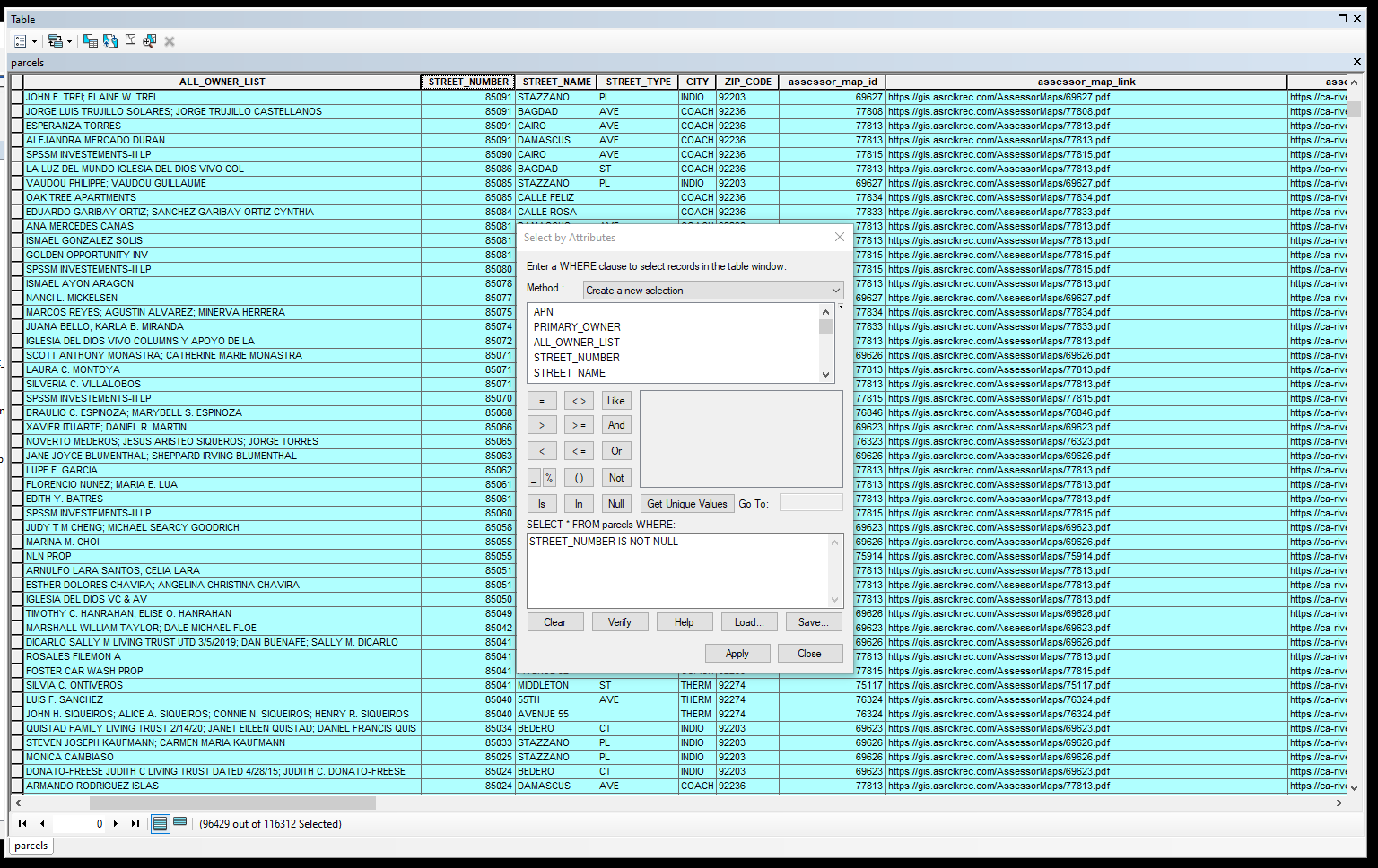
must select all record which STREET_NUMBER is not null.
otherwise CStr( null ) will cause error. https://www.w3schools.com/asp/func_cstr.asp
must select all record which STREET_NUMBER is not null.
STREET_NUMBER IS NOT NULL
field calculator : STREET_NUMBER is orginal long type
street_no = CStr ( [STREET_NUMBER] )
switch selection by select all STREET_NUMBER is null
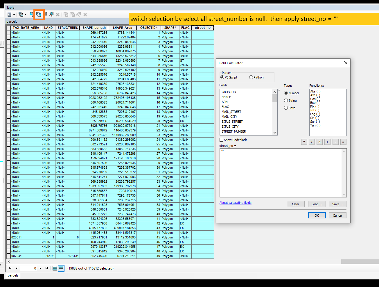
Field calculator do not need start editing mode
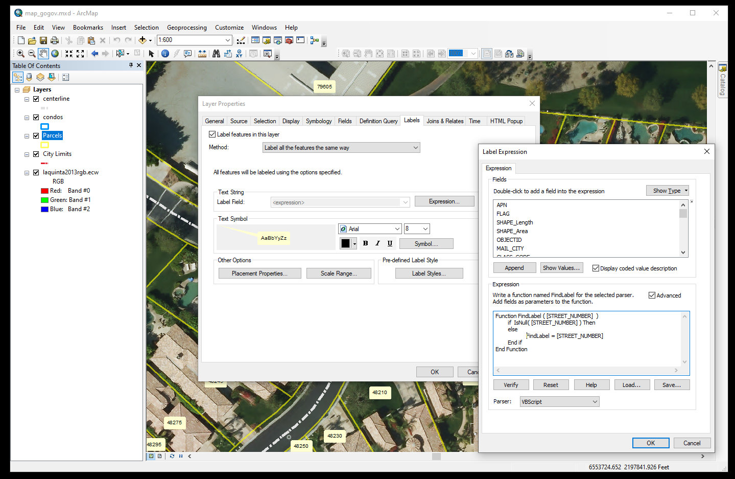
label the street number by apply:
Function FindLabel ( [STREET_NUMBER] )
if IsNull( [STREET_NUMBER] ) Then
else
FindLabel = [STREET_NUMBER]
End if
End Function
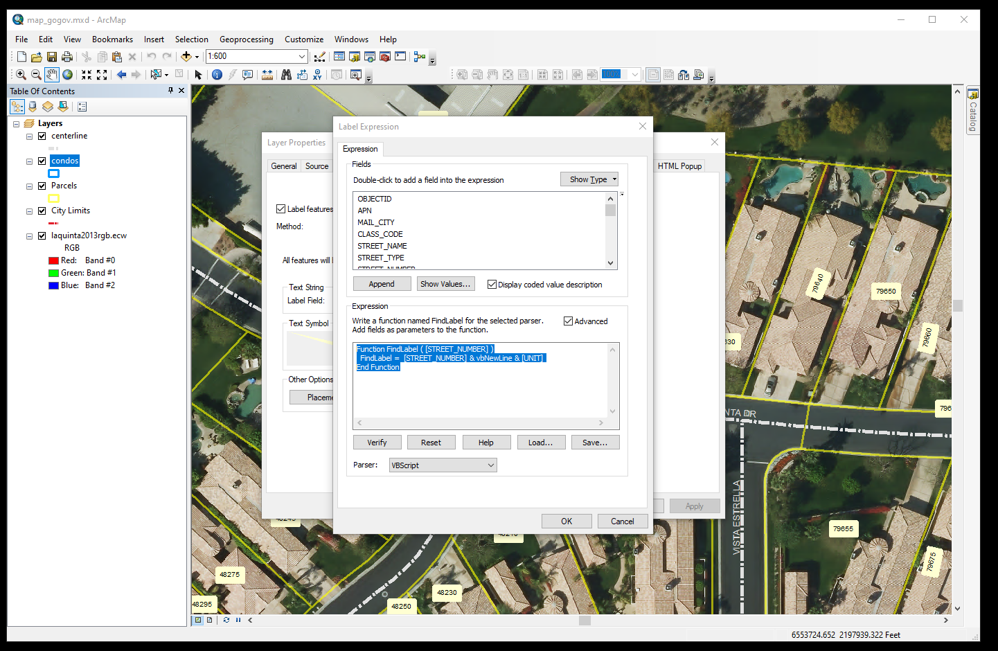
For condos, should show unit number as well, apply
Function FindLabel ( [STREET_NUMBER] )
FindLabel = [STREET_NUMBER] & vbNewLine & [UNIT]
End Function
separate city state zip fields
add 3 field:
mail_town
mail_state_abbreviation
mail_zip_code
MUST unselect all, before you proceed following steps
step 1:
mail_zip_code = Len([MAIL_CITY])
mail_state_abbreviation = [mail_zip_code] -9
if it is negative number, set it to 0
mail_town = Left( [MAIL_CITY], [mail_state_abbreviation] )
step 2:
mail_zip_code = Right( [MAIL_CITY], 8)
mail_state_abbreviation = Left( [mail_zip_code], 2)
step 3:
mail_zip_code = Right( [MAIL_CITY], 5)
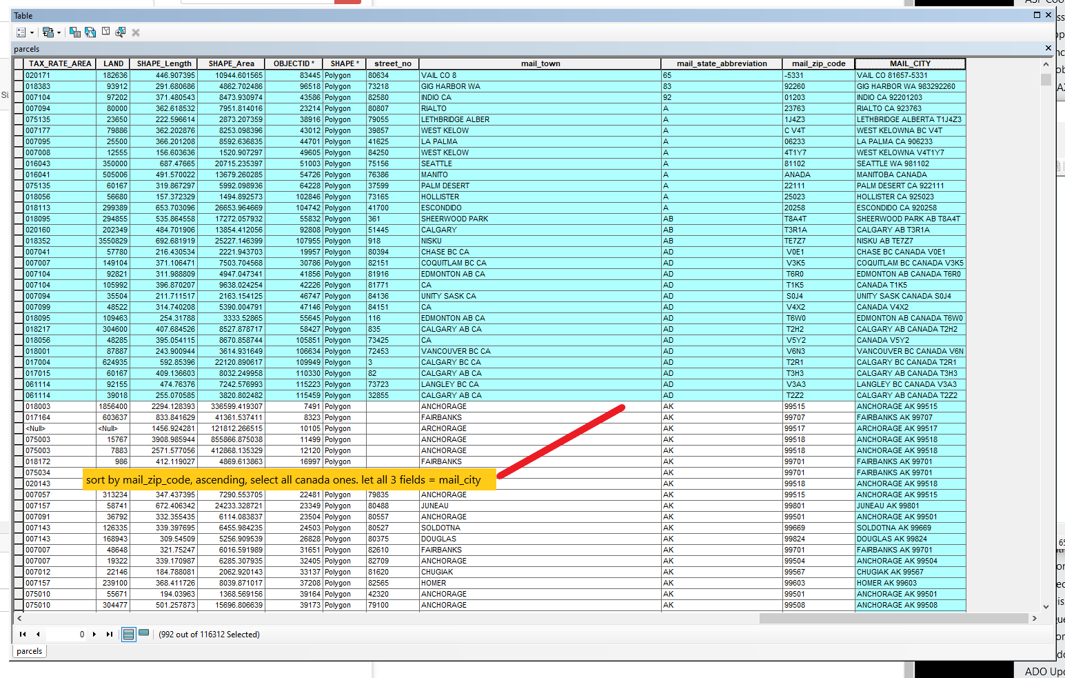
step 4: clean canada
sort mail_zip_code or mail_state_abbreviation ascending
select all canada ones
let all 3 field = same mail_city
mail_town =[MAIL_CITY]
mail_state_abbreviation =[MAIL_CITY]
mail_zip_code =[MAIL_CITY]