Why we need compress multiple zone overlay into single layer?
This single zone layer ( single shape file ) carry one basic zone layer + 3 overlay layers
1: basic zone model; 2: mixed use model; 3: affordable housing model; 4: hillside conservation model
Basic zone + 3 overlay zone PDF is here
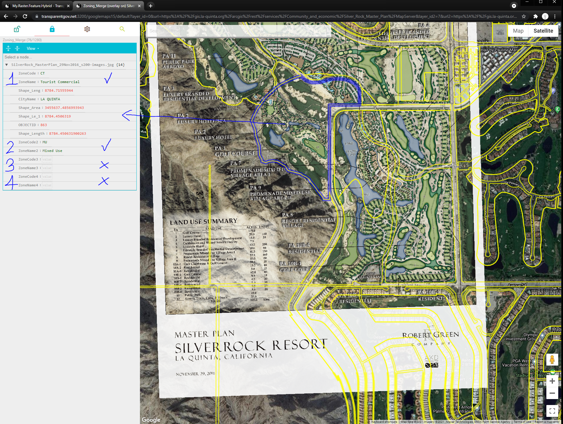
For example, the blue highlighted area, associated with only model 1 (Tourist Commercial) and 2 (Mixed Use)
Not associate with model 3 (affordable housing) and 4 (hillside conservation)
Click here to open in a new tab
Using one shape file to hold multiple layers is convenient and efficent when you update zone (boundary, designation, etc..)
If you spread out into multiple layers, you will need to update each layer for every zone change.
For example you have 10 overlays, 10 zone change, you will have to update 10(zone change) x 10(overlaye) = 100 times.
If you compress l0 overlays into single one shape file, 1 zone change only need to update 1 time for all 10 layers.
100 times editing reduce to 10 times.
Let's look at this example, compress 3 layers into 1 shape file.
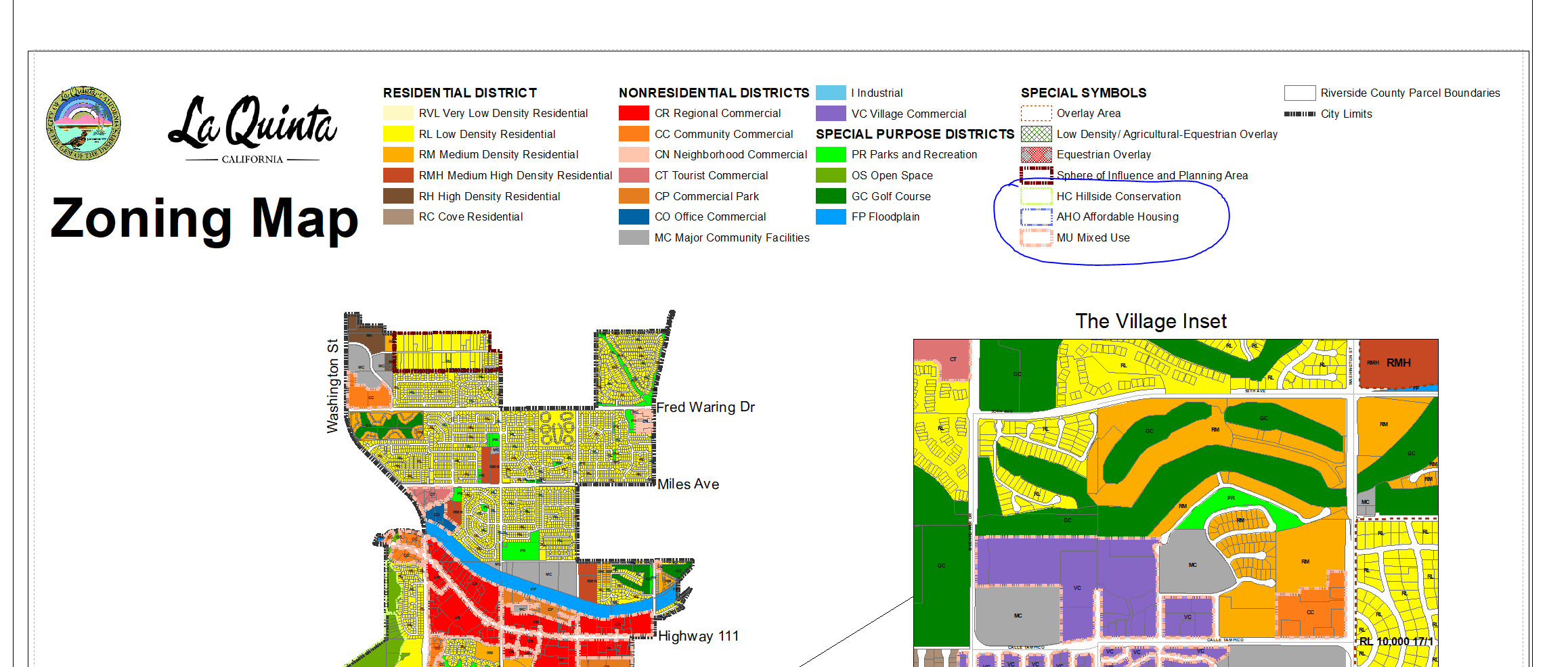
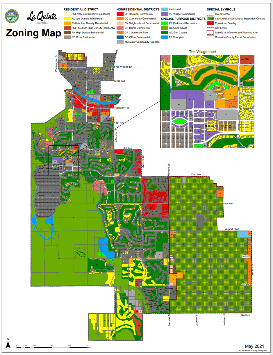
1) Basic Zoning District
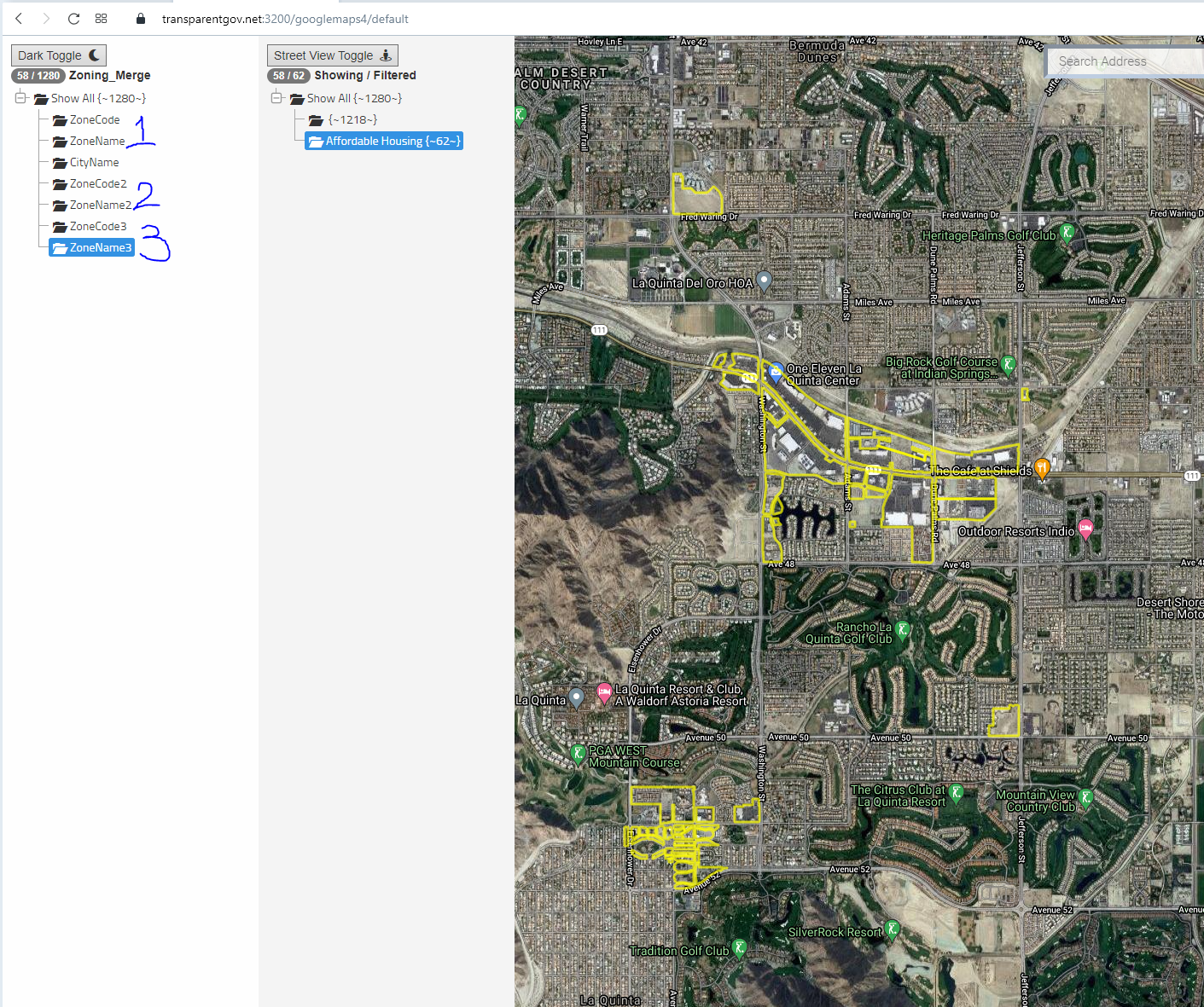
This is basic zoning district, (layer 1, ZoneCode, ZoneName )
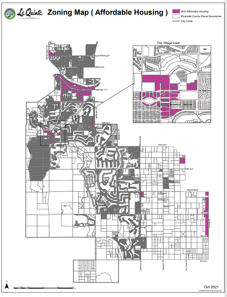
2) Overlay District, overlay on top of basic district
This is AHO Affordable Housing Overlay District (layer 2, ZoneCode2, ZoneName2 )
Municipal Code is here:
9.110.100 - AHO Affordable Housing Overlay District. | Municipal Code | La Quinta, CA | Municode Library
3) Another Overlay District, overlay on top of basic district
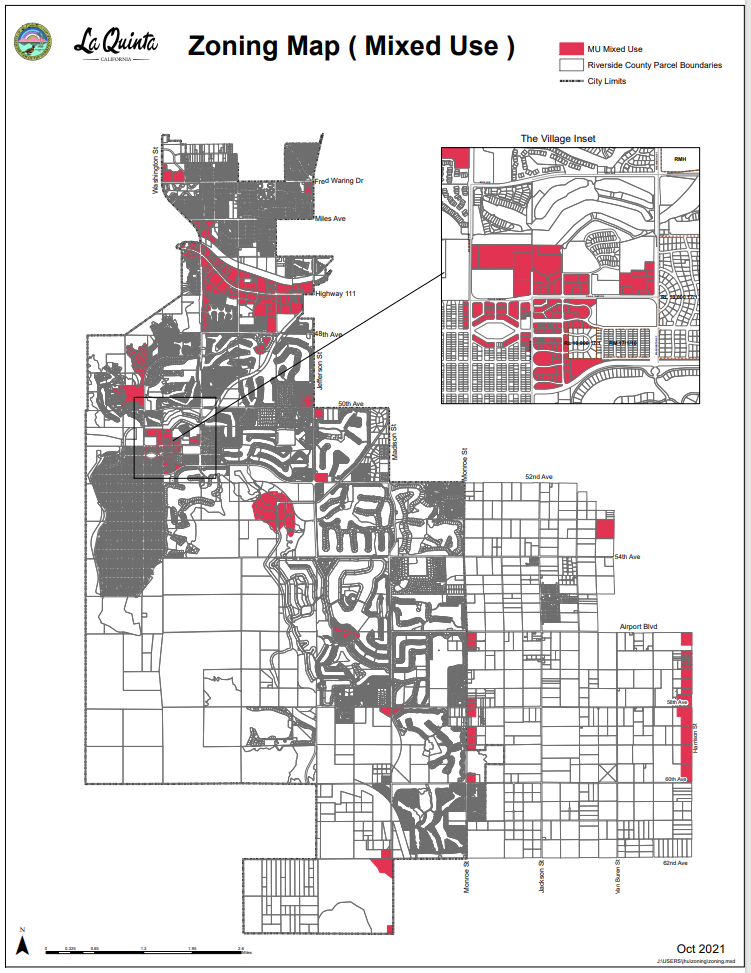
This is MU Mixed Use Overlay District (layer 3, ZoneCode3, ZoneName3 )
Municipal Code is here:
9.110.120 - Mixed Use Overlay District. | Municipal Code | La Quinta, CA | Municode Library
Let's compress all above 3 layers into one shape file. See blue mark 1, 2, 3, cooresponding to each layers.
If you need to update this blue polygon, you only need to update once, all 3 layers get updated at the same time.
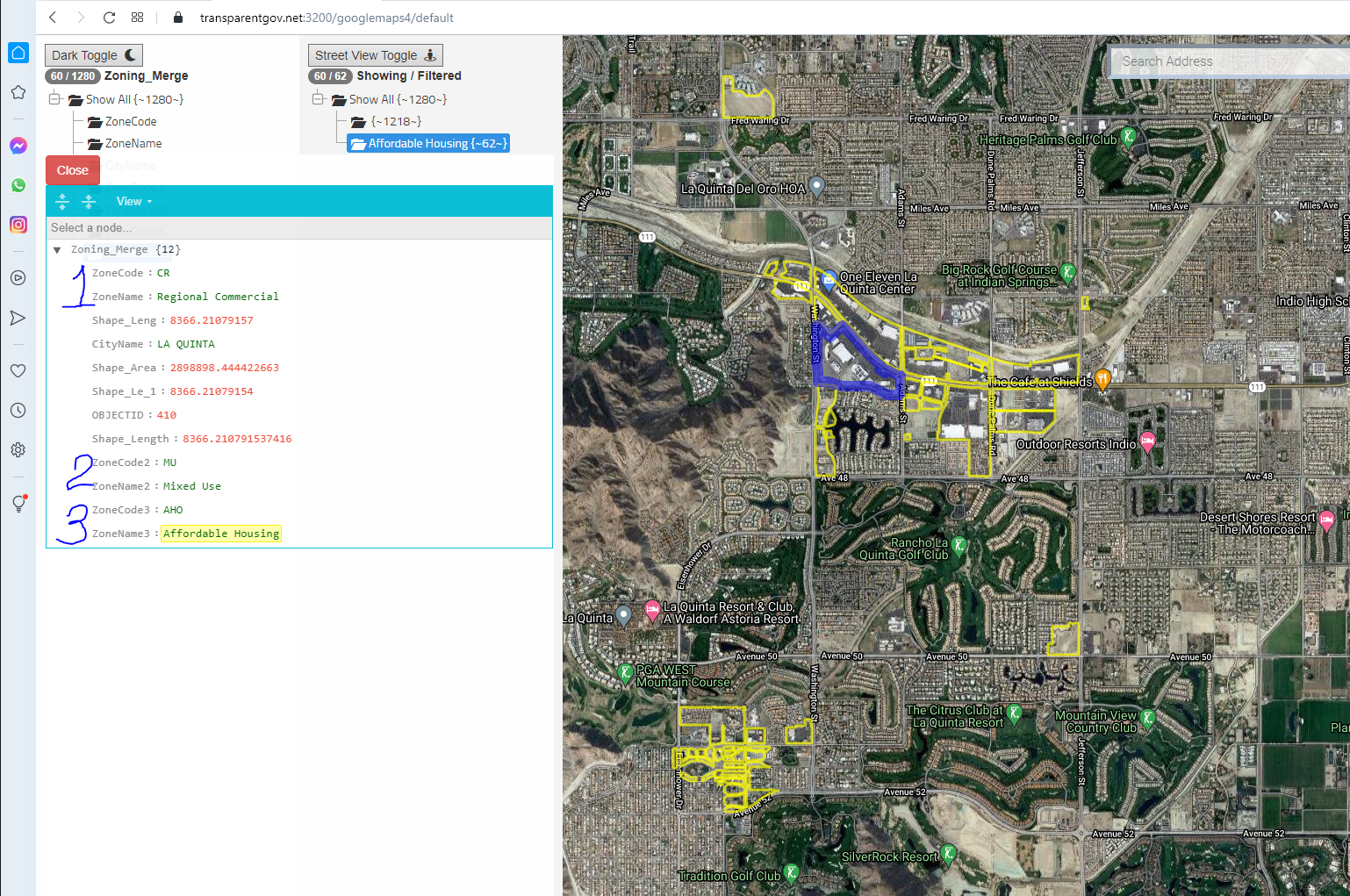
If you want to see each different layers, you can click ZoneName3 for AHO overlaye , ZoneName2 for MU overlaye, ZoneName for baslc zone district.
Here is interactive sample you can try, click
Click here to open in a new tab
More click here
Click here to open in a new tab